Compare Notoacmea daedala
| toggle to add to compare list |
Taxonomy
Family: LOTTIIDAE Full Classification: Genus Synonyms: =Conacmea W.R.B. Oliver, 1926 =Notoacmea (Conacmea) W.R.B. Oliver, 1926 =Notoacmea (Notoacmea) Iredale, 1915 =Notoacmea (Parvacmea) Iredale, 1915 =Notoacmea (Subacmea) W.R.B. Oliver, 1926 =Parvacmea Iredale, 1915 =Subacmea W.R.B. Oliver, 1926 =Thalassacmea W.R.B. Oliver, 1926 Synonymised Names: =Acmaea daedala Suter, 1907 |
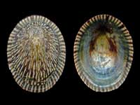
Images: Notoacmea daedala (Suter, 1907)
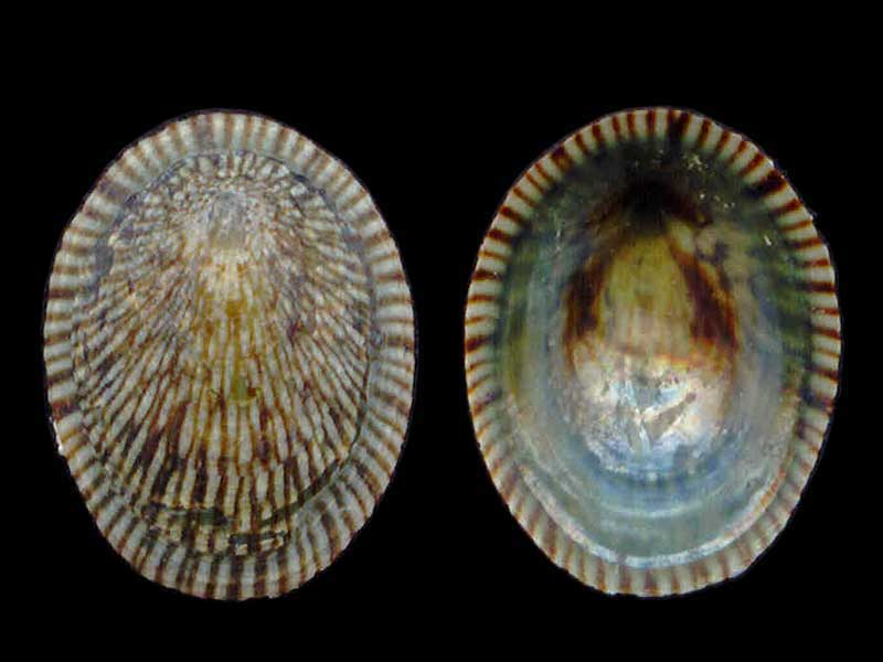
Cape Campbell, Marlborough. Mary Agnes Wotton Collection
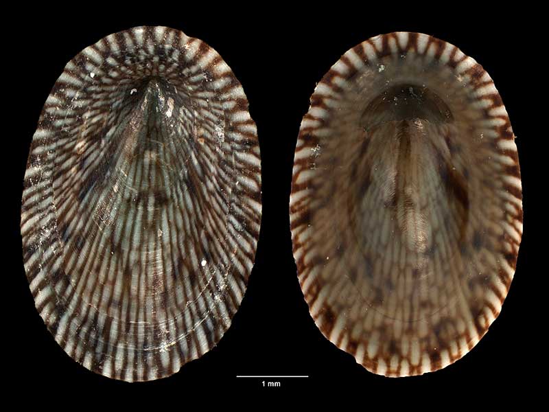
Collected 27 Aug 2006, Titahi Bay, N of Wellington, NZ (M.184289). © Museum of New Zealand Te Papa Tongarewa (CC-BY-NC-ND)
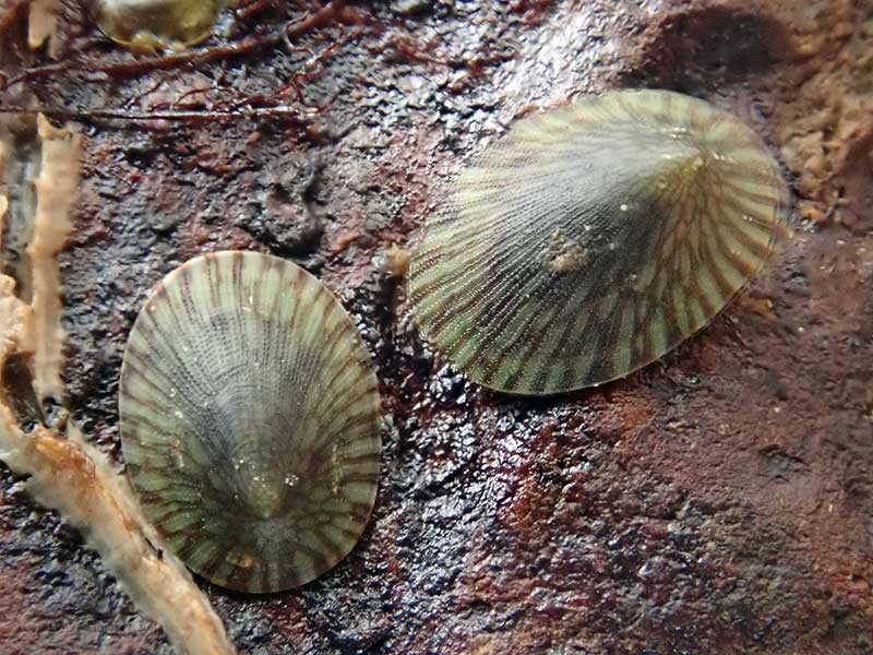
Alive under rocks at low tide. Houhora Heads, Far North, NZ. 8-10mm
Taxonomy
Family: LOTTIIDAE Full Classification: Genus Synonyms: =Conacmea W.R.B. Oliver, 1926 =Notoacmea (Conacmea) W.R.B. Oliver, 1926 =Notoacmea (Notoacmea) Iredale, 1915 =Notoacmea (Parvacmea) Iredale, 1915 =Notoacmea (Subacmea) W.R.B. Oliver, 1926 =Parvacmea Iredale, 1915 =Subacmea W.R.B. Oliver, 1926 =Thalassacmea W.R.B. Oliver, 1926 Synonymised Names: =Acmaea daedala Suter, 1907 |
Details: Notoacmea daedala (Suter, 1907)
Size/Grows to:
Length 16mm, Width 14mm, Height 6mm
Distribution:
North, South and Stewart Islands
Geographical Range:
ACF
Notes:
Species Links
Distribution Map
References and Publications
- Nakano, T., Marshall, B.A., Kennedy, M., Spencer, H.G. 2009 The phylogeny and taxonomy of New Zealand Notoacmea and Patelloida species (Mollusca: Patellogastropoda: Lottiidae) inferred from DNA sequences, Molluscan Research, 29(1) (p.45)
- Powell, A.W.B. 1979 New Zealand Mollusca: Marine, Land and Freshwater Shells, Collins, Auckland (p.48)
- Suter, H. 1907 Revision of the New Zealand Acmaeidae, with descriptions of new species and subspecies, Proceedings of the Malacological Society of London, 7 (p.323) Original Description
*98 © Museum of New Zealand Te Papa Tongarewa (CC-BY-NC-ND)
Key to Geographical Ranges

The symbols K.A.C.F.M.An. are used to indicate the geographical range of the species.
They have been adopted to give an approximation of the range of each species within New Zealand.
K=
Kermadec Islands
A=
Aupourian - Kaipara Harbour, north around North Cape, encompassing the Three Kings Islands and south to East Cape
C=
Cookian - Lower North Island and the northern part of the South Island
F=
Forsterian - Otago, Fiordland and Stewart Island
M=
Moriorian - Chatham Islands, Pitt Island
An=
Antipodean - Subantarctic Islands of New Zealand
Fw =
Freshwater
L =
Land
N =
North Island
S =
South Island
R =
Recent
Sf =
Subfossil
Fo =
Fossil
Recently Viewed
Compare Species (
/6)