Compare Haliotis virginea
| toggle to add to compare list |
Taxonomy
Family: HALIOTIDAE Full Classification: Mollusca (Phylum) > Gastropoda (Class) > Vetigastropoda (Subclass) > Lepetelllida (Order) > Haliotoidea (Superfamily) > Haliotidae (Family) > Haliotis (Genus) > virginea (Species) Genus Synonyms: =Haliotis (Padollus) Montfort, 1810 =Haliotis (Paua) Fleming, 1952 =Haliotis (Sulculus) H. & A. Adams, 1854 Synonymised Names: =Haliotis (Paua) virginea Gmelin, 1791 alternate representation =Haliotis crispata Gould, 1847 =Haliotis gibba Philippi, 1846 =Haliotis huttoni Filhol, 1880 =Haliotis marmorata Reeve, 1846 =Haliotis subvirginea Weinkauff, 1883 =Haliotis virginea Reeve, 1846 =Haliotis virginea crispata Gould, 1847 =Haliotis virginea huttoni Filhol, 1880 =Haliotis virginea morioria Powell, 1938 =Haliotis virginea stewartae Jones & Owen, 2004 =Haliotis virginea virginea Gmelin, 1791 |
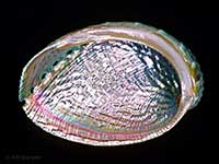
Images: Haliotis virginea Gmelin, 1791
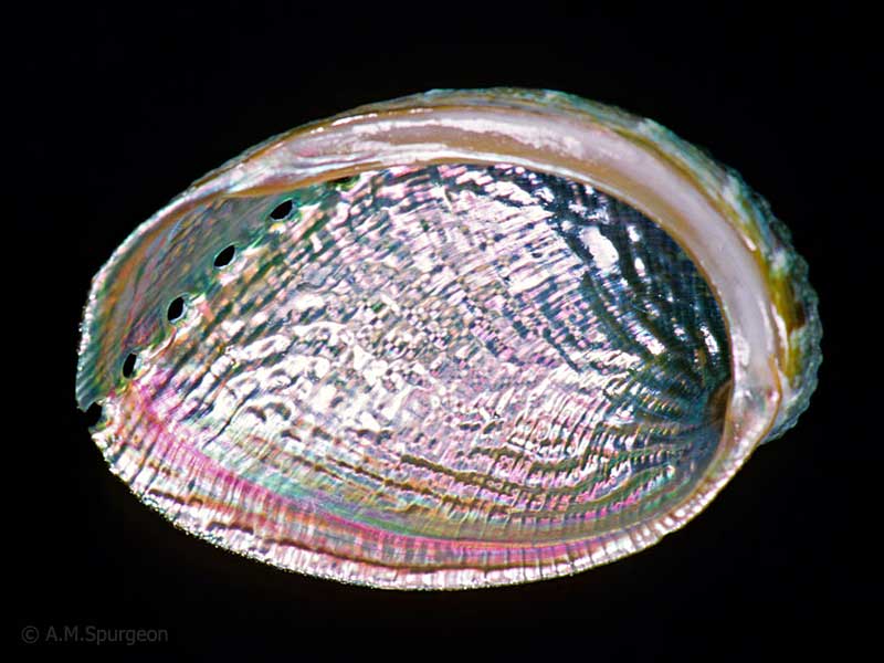
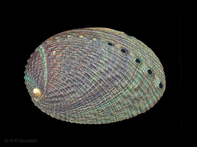
At and below low spring tide under rocks, Otago Peninsula, NZ. 70mm
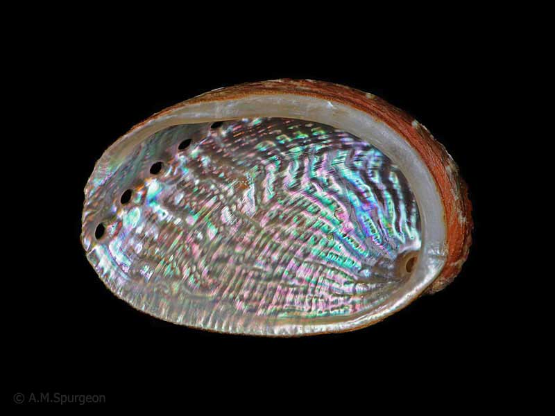
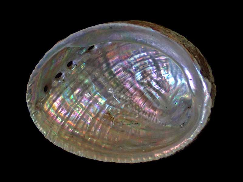
The northern crispata form from north of Auckland, NZ. 41mm
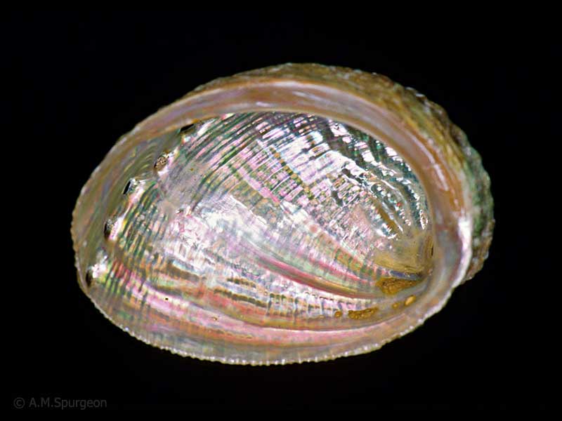
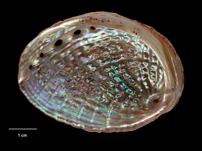
The morioria form, found on the Chatham Islands, NZ. 53mm
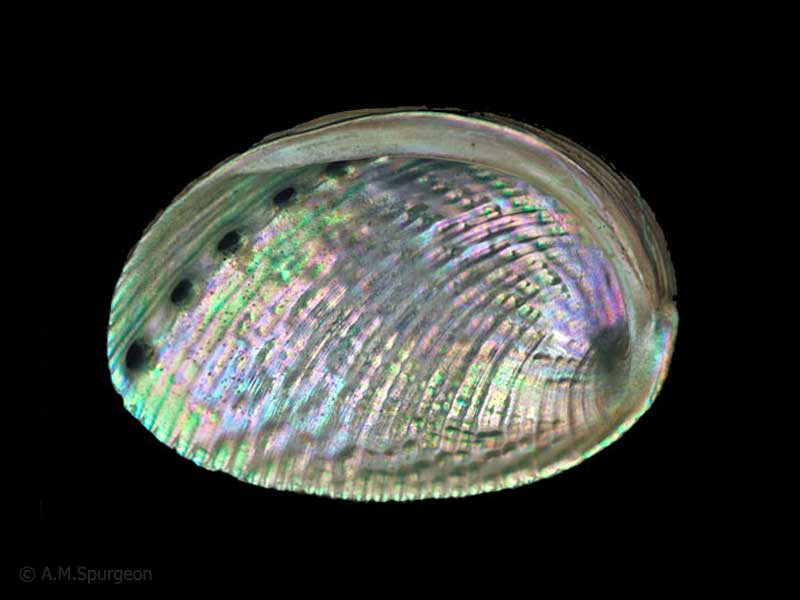
The huttoni form, Perseverance Harbour, Campbell Island. 51mm
The huttoni form, Perseverance Harbour, Campbell Island. 51mm
The huttoni form, Auckland Islands, NZ. 69mm
Holotype of Haliotis virginea stewartae, collected Antipodes Islands, NZ (M.154176). © Museum of New Zealand Te Papa Tongarewa (CC-BY-NC-ND)
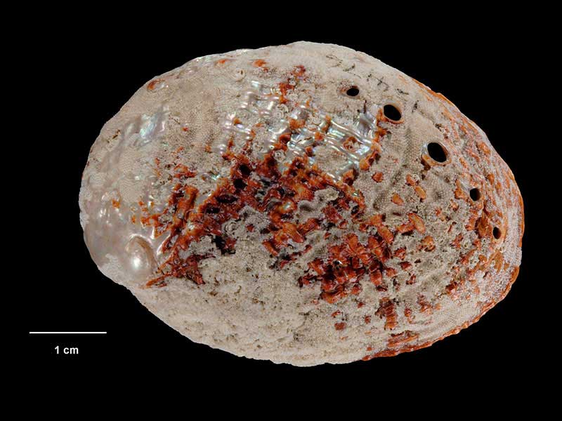
Holotype of Haliotis virginea stewartae, collected Antipodes Islands, NZ (M.154176). © Museum of New Zealand Te Papa Tongarewa (CC-BY-NC-ND)
Taxonomy
Family: HALIOTIDAE Full Classification: Mollusca (Phylum) > Gastropoda (Class) > Vetigastropoda (Subclass) > Lepetelllida (Order) > Haliotoidea (Superfamily) > Haliotidae (Family) > Haliotis (Genus) > virginea (Species) Genus Synonyms: =Haliotis (Padollus) Montfort, 1810 =Haliotis (Paua) Fleming, 1952 =Haliotis (Sulculus) H. & A. Adams, 1854 Synonymised Names: =Haliotis (Paua) virginea Gmelin, 1791 alternate representation =Haliotis crispata Gould, 1847 =Haliotis gibba Philippi, 1846 =Haliotis huttoni Filhol, 1880 =Haliotis marmorata Reeve, 1846 =Haliotis subvirginea Weinkauff, 1883 =Haliotis virginea Reeve, 1846 =Haliotis virginea crispata Gould, 1847 =Haliotis virginea huttoni Filhol, 1880 =Haliotis virginea morioria Powell, 1938 =Haliotis virginea stewartae Jones & Owen, 2004 =Haliotis virginea virginea Gmelin, 1791 |
Details: Haliotis virginea Gmelin, 1791
Size/Grows to:
Length 73mm, Width 45mm
Distribution:
North, South and Stewart Island, Chathams, Campbell and Auckland Islands
Geographical Range:
ACFMAn
Notes:
Species Links
Distribution Map
References and Publications
- Walton, K., Marshall, B.A., Rawlence, N.J., Spencer, H.G. 2024 Haliotis virginea Gmelin, 1791 and a new abalone from Aotearoa New Zealand (Mollusca: Gastropoda: Haliotidae), Molluscan Research (p.1)
- Mead, K. Nov/2020 A long distance traveller, Cookia, 32 (p.5)
- Owen, B., Kershaw, R. 2014 Iconography of the Haliotis species and subspecies of Australia and New Zealand, The Festivus, 46 (p.5)
- Eagle, M.K. Dec/2010 Aspects of Abalone Aquaculture and Polyculture, Poirieria, 35 (p.11)
- Jones, M., Owen, B. 2004 Description of Haliotis virginea stewartae new subspecies (Gastropoda) from Subantarctic islands of New Zealand, Of Sea and Shore, 26(2) (p.81) Original Description
- Eagle, M.K. 2002 Review of fossil Haliotidae (Gastropoda) from New Zealand with description of a new early Miocene species., Records of the Auckland Institute and Museum, 39 (p.35)
- Powell, A.W.B. 1979 New Zealand Mollusca: Marine, Land and Freshwater Shells, Collins, Auckland (p.37)
- Powell, A.W.B. 1938 Additions to the recent molluscan fauna of New Zealand, Records of the Auckland Institute and Museum, 2 (p.165) Original Description
- Gould, A. 1847 Description of species of shells from the collection of the Exploring Expedition, Proceedings of the Boston Society of Natural History, 2 (p.251) Original Description
*98 © Museum of New Zealand Te Papa Tongarewa (CC-BY-NC-ND)
Key to Geographical Ranges

The symbols K.A.C.F.M.An. are used to indicate the geographical range of the species.
They have been adopted to give an approximation of the range of each species within New Zealand.
K=
Kermadec Islands
A=
Aupourian - Kaipara Harbour, north around North Cape, encompassing the Three Kings Islands and south to East Cape
C=
Cookian - Lower North Island and the northern part of the South Island
F=
Forsterian - Otago, Fiordland and Stewart Island
M=
Moriorian - Chatham Islands, Pitt Island
An=
Antipodean - Subantarctic Islands of New Zealand
Fw =
Freshwater
L =
Land
N =
North Island
S =
South Island
R =
Recent
Sf =
Subfossil
Fo =
Fossil
Recently Viewed
Compare Species (
/6)