Compare Emarginula striatula
| toggle to add to compare list |
Taxonomy
Family: Subfamily: FISSURELLIDAE: EMARGINULINAE Full Classification: Mollusca (Phylum) > Gastropoda (Class) > Vetigastropoda (Subclass) > Lepetelllida (Order) > Fissurelloidea (Superfamily) > Fissurellidae (Family) > Emarginulinae (Subfamily) > Emarginula (Genus) > striatula (Species) Genus Synonyms: =Emarginula (Subzeidora) Iredale, 1924 Synonymised Names: =Emarginula lophelia Beu, 1966 =Emarginula striatula valentior Finlay, 1928 |
Images: Emarginula striatula Quoy & Gaimard, 1834
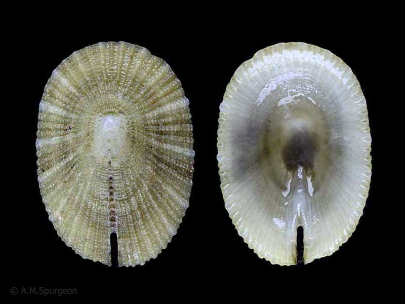
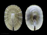
In beach drift, Bland Bay, Northland, NZ. 20mm
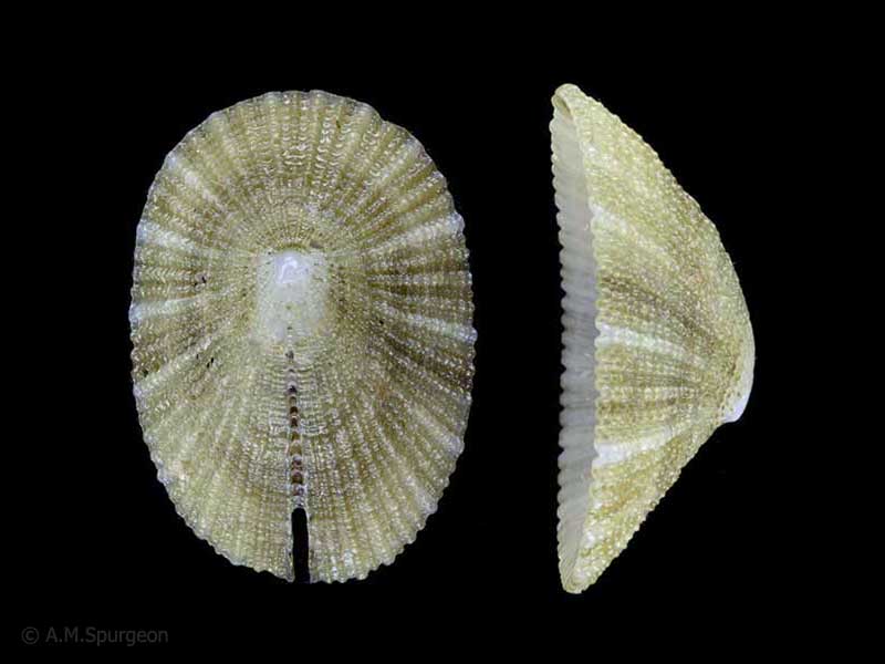
In beach drift, Bland Bay, Northland, NZ. 20mm
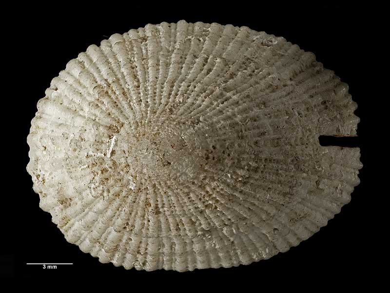
Holotype of Emarginula striatula valentior Finlay, collected Jan 1924, Chatham Islands, NZ (MA70261). © Auckland Museum (CC-BY)
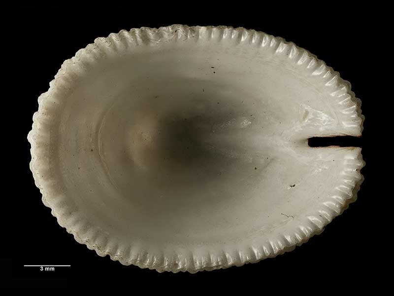
Holotype of Emarginula striatula valentior Finlay, collected Jan 1924, Chatham Islands, NZ (MA70261). © Auckland Museum (CC-BY)
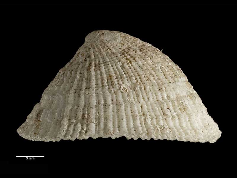
Holotype of Emarginula striatula valentior Finlay, collected Jan 1924, Chatham Islands, NZ (MA70261). © Auckland Museum (CC-BY)
Taxonomy
Family: Subfamily: FISSURELLIDAE: EMARGINULINAE Full Classification: Mollusca (Phylum) > Gastropoda (Class) > Vetigastropoda (Subclass) > Lepetelllida (Order) > Fissurelloidea (Superfamily) > Fissurellidae (Family) > Emarginulinae (Subfamily) > Emarginula (Genus) > striatula (Species) Genus Synonyms: =Emarginula (Subzeidora) Iredale, 1924 Synonymised Names: =Emarginula lophelia Beu, 1966 =Emarginula striatula valentior Finlay, 1928 |
Details: Emarginula striatula Quoy & Gaimard, 1834
Size/Grows to:
Length 33mm, Width 17mm
Distribution:
North, South, Stewart, Chathams, Snares, Auckland and Bounty Islands. In beach drift and living below low tide
Geographical Range:
ACFMAn
Notes:
Species Links
Distribution Map
References and Publications
- Bracegirdle, S. Nov/2003 Four Limpets - Owhiro Bay, Wellington, Cookia, 15 (p.20)
- Powell, A.W.B. 1979 New Zealand Mollusca: Marine, Land and Freshwater Shells, Collins, Auckland (p.38)
- Beu, A.G., Climo, F.M. 1974 Mollusca from a recent coral community in Palliser Bay, Cook Strait, New Zealand Journal of Marine and Freshwater Research, 8(2) (p.314)
*98 © Museum of New Zealand Te Papa Tongarewa (CC-BY-NC-ND)
Key to Geographical Ranges

The symbols K.A.C.F.M.An. are used to indicate the geographical range of the species.
They have been adopted to give an approximation of the range of each species within New Zealand.
K=
Kermadec Islands
A=
Aupourian - Kaipara Harbour, north around North Cape, encompassing the Three Kings Islands and south to East Cape
C=
Cookian - Lower North Island and the northern part of the South Island
F=
Forsterian - Otago, Fiordland and Stewart Island
M=
Moriorian - Chatham Islands, Pitt Island
An=
Antipodean - Subantarctic Islands of New Zealand
Fw =
Freshwater
L =
Land
N =
North Island
S =
South Island
R =
Recent
Sf =
Subfossil
Fo =
Fossil
Compare Species (
/6)