Compare Coelotrochus oppressus
| toggle to add to compare list |
Taxonomy
Family: Subfamily: TROCHIDAE: TROCHINAE Full Classification: Mollusca (Phylum) > Gastropoda (Class) > Vetigastropoda (Subclass) > Trochida (Order) > Trochoidea (Superfamily) > Trochidae (Family) > Trochinae (Subfamily) > Coelotrochus (Genus) > oppressus (Species) Genus Synonyms: =Anthora Gray, 1857 =Chlorostoma (Neozelandia) Cossmann, 1918 =Thorista Iredale, 1915 =Thoristella Iredale, 1915 =Trochus (Anthora) Gray, 1857 =Trochus (Coelotrochus) P. Fischer, 1879 =Trochus (Thorista) Iredale, 1915 Synonymised Names: =Gibbula oppressa Hutton, 1878 =Thoristella oppressa (Hutton, 1878) =Trochus (Infundibulum) oppressus (Hutton, 1878) =Trochus oppressus (Hutton, 1878) |
Images: Coelotrochus oppressus (Hutton, 1878)

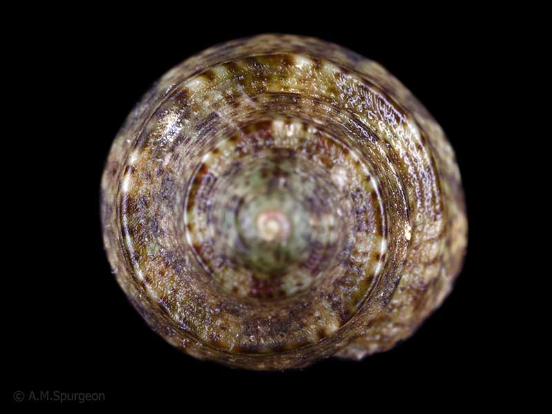
On seaweed and under rocks at low tide, Tutukaka Harbour, Whangarei, Northland, NZ. 6mm
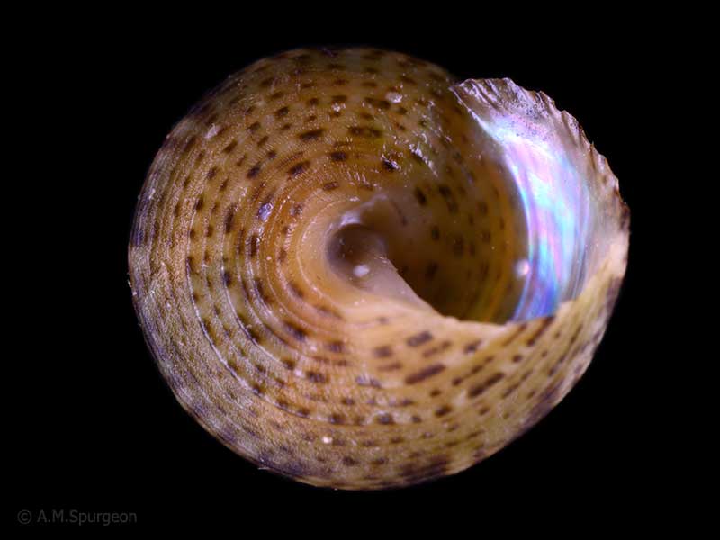
On seaweed and under rocks at low tide, Tutukaka Harbour, Whangarei, Northland, NZ. 6mm
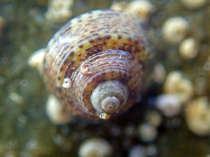
On seaweed and under rocks at low tide, Tutukaka Harbour, Whangarei, Northland, NZ. 6mm
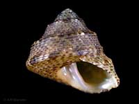
On the underside of stones at low tide. Henderson Bay, Far North, NZ. 5mm
Taxonomy
Family: Subfamily: TROCHIDAE: TROCHINAE Full Classification: Mollusca (Phylum) > Gastropoda (Class) > Vetigastropoda (Subclass) > Trochida (Order) > Trochoidea (Superfamily) > Trochidae (Family) > Trochinae (Subfamily) > Coelotrochus (Genus) > oppressus (Species) Genus Synonyms: =Anthora Gray, 1857 =Chlorostoma (Neozelandia) Cossmann, 1918 =Thorista Iredale, 1915 =Thoristella Iredale, 1915 =Trochus (Anthora) Gray, 1857 =Trochus (Coelotrochus) P. Fischer, 1879 =Trochus (Thorista) Iredale, 1915 Synonymised Names: =Gibbula oppressa Hutton, 1878 =Thoristella oppressa (Hutton, 1878) =Trochus (Infundibulum) oppressus (Hutton, 1878) =Trochus oppressus (Hutton, 1878) |
Details: Coelotrochus oppressus (Hutton, 1878)
Size/Grows to:
Width 6mm, Height 5.5mm
Distribution:
Three Kings Islands, North Island to Mahia
Geographical Range:
AC
Notes:
Species Links
Distribution Map
References and Publications
- Marshall, B.A. 1998 A review of the Recent Trochini of New Zealand (Mollusca: Gastropoda: Trochidae), Molluscan Research, 19 (p.91)
- Powell, A.W.B. 1979 New Zealand Mollusca: Marine, Land and Freshwater Shells, Collins, Auckland (p.60)
- Hutton, F.W. 1878 Révision des coquilles de la Nouvelle-Zélande et des Iles Chatham, Journal de Conchyliologie, 26 (p.32) Original Description
*98 © Museum of New Zealand Te Papa Tongarewa (CC-BY-NC-ND)
Key to Geographical Ranges

The symbols K.A.C.F.M.An. are used to indicate the geographical range of the species.
They have been adopted to give an approximation of the range of each species within New Zealand.
K=
Kermadec Islands
A=
Aupourian - Kaipara Harbour, north around North Cape, encompassing the Three Kings Islands and south to East Cape
C=
Cookian - Lower North Island and the northern part of the South Island
F=
Forsterian - Otago, Fiordland and Stewart Island
M=
Moriorian - Chatham Islands, Pitt Island
An=
Antipodean - Subantarctic Islands of New Zealand
Fw =
Freshwater
L =
Land
N =
North Island
S =
South Island
R =
Recent
Sf =
Subfossil
Fo =
Fossil
Recently Viewed
Compare Species (
/6)