Compare Pisinna rufoapicata
| toggle to add to compare list |
Taxonomy
Family: ANABATHRIDAE Full Classification: Mollusca (Phylum) > Gastropoda (Class) > Caenogastropoda (Subclass) > Littorinimorpha (Order) > Truncatelloidea (Superfamily) > Anabathridae (Family) > Pisinna (Genus) > rufoapicata (Species) Genus Synonyms: =Estea Iredale, 1915 =Estea (Microestea) Ponder, 1965 =Feldestea Iredale, 1955 =Hagenmulleria Bourguignat, 1881 =Microestea Ponder, 1965 =Nodulestea Iredale, 1955 =Pisanna Monterosato, 1878 (misspelling) Synonymised Names: =Estea rufoapicata Suter, 1908 =Estea rufoapicata latior Dell, 1956 =Rissoa rufoapicata Suter, 1908 |
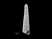
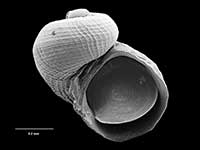
Images: Pisinna rufoapicata (Suter, 1908)

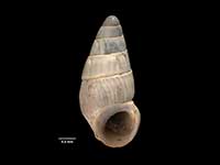
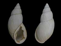
Holotype of Estea rufoapicata latior Dell, 1956, collected 16 Aug 1955, Taiaroa Canyon, off Otago Peninsula, NZ (M.009083). ~3.5mm. © Museum of New Zealand Te Papa Tongarewa (CC-BY-NC-ND)
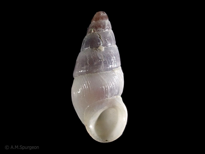
Collected in 150-200 metres, Taiaroa Canyon, Otago, NZ. 3.0mm
Taxonomy
Family: ANABATHRIDAE Full Classification: Mollusca (Phylum) > Gastropoda (Class) > Caenogastropoda (Subclass) > Littorinimorpha (Order) > Truncatelloidea (Superfamily) > Anabathridae (Family) > Pisinna (Genus) > rufoapicata (Species) Genus Synonyms: =Estea Iredale, 1915 =Estea (Microestea) Ponder, 1965 =Feldestea Iredale, 1955 =Hagenmulleria Bourguignat, 1881 =Microestea Ponder, 1965 =Nodulestea Iredale, 1955 =Pisanna Monterosato, 1878 (misspelling) Synonymised Names: =Estea rufoapicata Suter, 1908 =Estea rufoapicata latior Dell, 1956 =Rissoa rufoapicata Suter, 1908 |
Details: Pisinna rufoapicata (Suter, 1908)
Size/Grows to:
Height 3.6mm, Width 1.6mm
Distribution:
South of South Island, Snares and Chatham Islands
Geographical Range:
CFMAn
Notes:
Species Links
Distribution Map
References and Publications
- Powell, A.W.B. 1979 New Zealand Mollusca: Marine, Land and Freshwater Shells, Collins, Auckland (p.102)
- Suter, H. 1908 Additions to the marine molluscan fauna of New Zealand, with descriptions of new species, Proceedings of the Malacological Society of London, 8 (p.28) Original Description
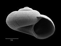
*98 © Museum of New Zealand Te Papa Tongarewa (CC-BY-NC-ND)
Key to Geographical Ranges

The symbols K.A.C.F.M.An. are used to indicate the geographical range of the species.
They have been adopted to give an approximation of the range of each species within New Zealand.
K=
Kermadec Islands
A=
Aupourian - Kaipara Harbour, north around North Cape, encompassing the Three Kings Islands and south to East Cape
C=
Cookian - Lower North Island and the northern part of the South Island
F=
Forsterian - Otago, Fiordland and Stewart Island
M=
Moriorian - Chatham Islands, Pitt Island
An=
Antipodean - Subantarctic Islands of New Zealand
Fw =
Freshwater
L =
Land
N =
North Island
S =
South Island
R =
Recent
Sf =
Subfossil
Fo =
Fossil
Compare Species (
/6)