Compare Potamopyrgus estuarinus
| toggle to add to compare list |
Taxonomy
Family: TATEIDAE Full Classification: Mollusca (Phylum) > Gastropoda (Class) > Caenogastropoda (Subclass) > Littorinimorpha (Order) > Truncatelloidea (Superfamily) > Tateidae (Family) > Potamopyrgus (Genus) > estuarinus (Species) |
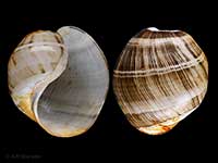
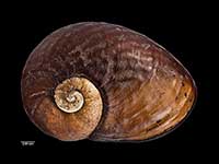
Images: Potamopyrgus estuarinus Winterbourn, 1971
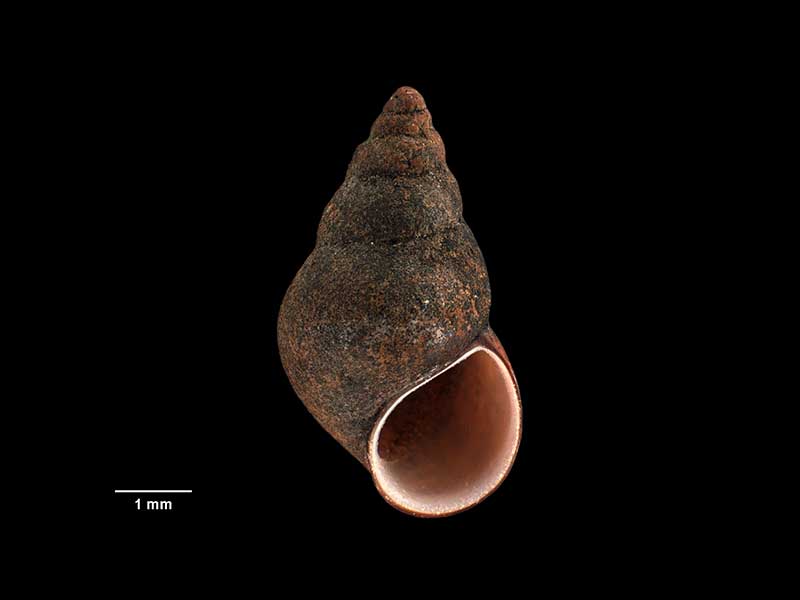
Holotype, collected 20 Aug 1966, Bell Block, New Plymouth, NZ (M.024112). © Museum of New Zealand Te Papa Tongarewa (CC-BY-NC-ND)
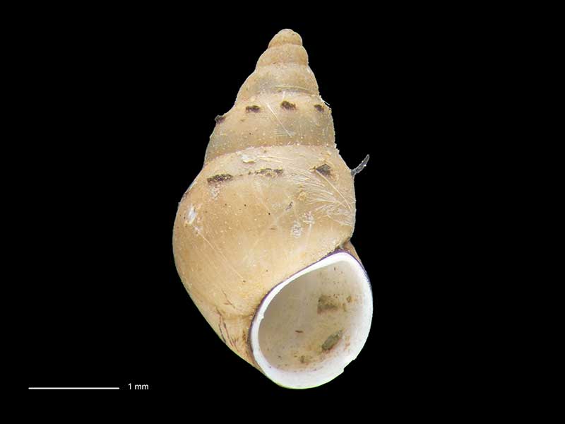
Collected Jul 1977, Porirua Harbour, Wellington, NZ. 4.3. Reproduced courtesy of Dave Roscoe
Taxonomy
Family: TATEIDAE Full Classification: Mollusca (Phylum) > Gastropoda (Class) > Caenogastropoda (Subclass) > Littorinimorpha (Order) > Truncatelloidea (Superfamily) > Tateidae (Family) > Potamopyrgus (Genus) > estuarinus (Species) |
Details: Potamopyrgus estuarinus Winterbourn, 1971
Size/Grows to:
Height 7mm
Distribution:
North and South Island. Brackish streams
Geographical Range:
Fw.N.S.
Notes:
Species Links
Distribution Map
References and Publications
- Haase, M. 2008 The radiation of hydrobiid gastropods in New Zealand: a revision including the description of new species based on morphology and mtDNA sequence information, Systematics and Biodiversity, 6(1) (p.104)
- Powell, A.W.B. 1979 New Zealand Mollusca: Marine, Land and Freshwater Shells, Collins, Auckland (p.122)
- Winterbourn, M.J. 1971 The New Zealand species of Potamopyrgus (Gastropoda: Hydrobiidae), Malacologia, 10 (p.286) Original Description
Key to Geographical Ranges

The symbols K.A.C.F.M.An. are used to indicate the geographical range of the species.
They have been adopted to give an approximation of the range of each species within New Zealand.
K=
Kermadec Islands
A=
Aupourian - Kaipara Harbour, north around North Cape, encompassing the Three Kings Islands and south to East Cape
C=
Cookian - Lower North Island and the northern part of the South Island
F=
Forsterian - Otago, Fiordland and Stewart Island
M=
Moriorian - Chatham Islands, Pitt Island
An=
Antipodean - Subantarctic Islands of New Zealand
Fw =
Freshwater
L =
Land
N =
North Island
S =
South Island
R =
Recent
Sf =
Subfossil
Fo =
Fossil

Compare Species (
/6)