Compare Malluvium calcareum
| toggle to add to compare list |
Taxonomy
Family: HIPPONICIDAE Full Classification: Mollusca (Phylum) > Gastropoda (Class) > Caenogastropoda (Subclass) > Littorinimorpha (Order) > Vanikoioidea (Superfamily) > Hipponicidae (Family) > Malluvium (Genus) > calcareum (Species) Synonymised Names: =Capulus calcareus Suter, 1909 |
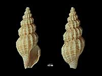
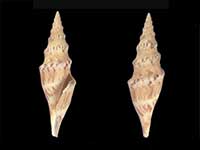
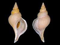
Images: Malluvium calcareum (Suter, 1909)
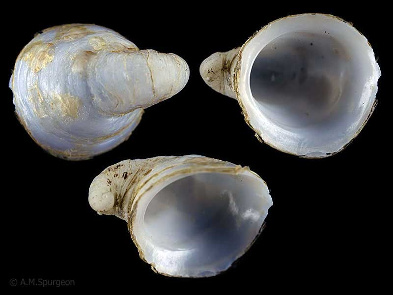
Living on Gastropod shells, trawled off White Island, Bay of Plenty, NZ. 11mm
Living on Gastropod shells, trawled off White Island, Bay of Plenty, NZ. 11mm
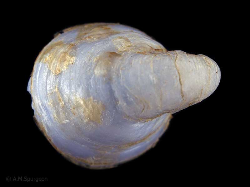
Living on Gastropod shells, trawled off White Island, Bay of Plenty, NZ. 11mm
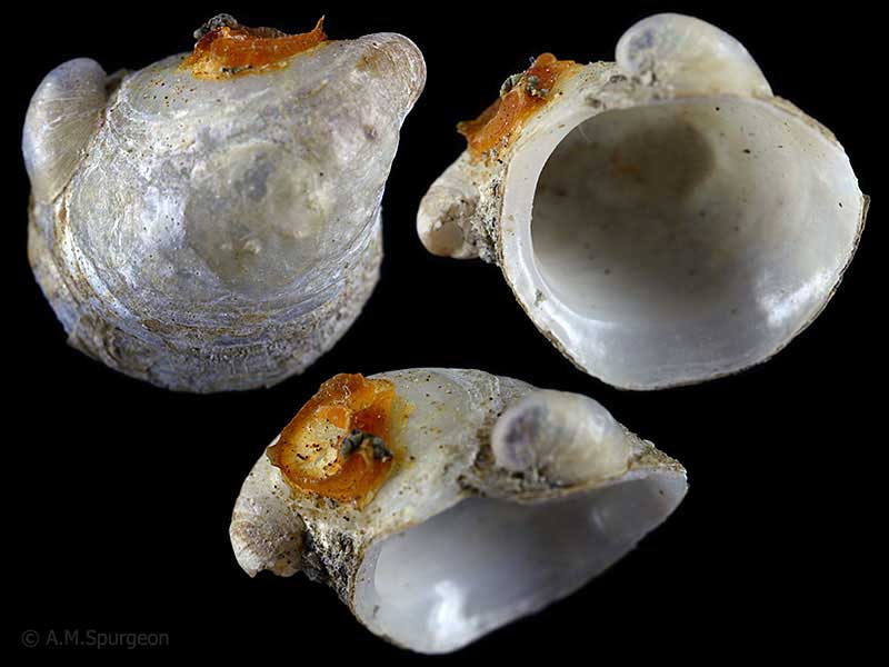
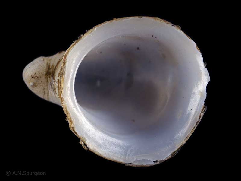
Trawled in deep water Bay of Plenty, NZ. 12mm
Taxonomy
Family: HIPPONICIDAE Full Classification: Mollusca (Phylum) > Gastropoda (Class) > Caenogastropoda (Subclass) > Littorinimorpha (Order) > Vanikoioidea (Superfamily) > Hipponicidae (Family) > Malluvium (Genus) > calcareum (Species) Synonymised Names: =Capulus calcareus Suter, 1909 |
Details: Malluvium calcareum (Suter, 1909)
Size/Grows to:
Length 22mm, Width 14mm
Distribution:
North, South, Chatham Islands, and southern ocean. Also Kermadec Islands
Geographical Range:
KACM
Notes:
Species Links
Distribution Map
References and Publications
- Powell, A.W.B. 1979 New Zealand Mollusca: Marine, Land and Freshwater Shells, Collins, Auckland (p.146)
- Suter, H. 1909 Scientific results of the New Zealand government trawling expedition, 1908. Mollusca., Records of the Canterbury Museum, 1 (p.122) Original Description
*98 © Museum of New Zealand Te Papa Tongarewa (CC-BY-NC-ND)
Key to Geographical Ranges

The symbols K.A.C.F.M.An. are used to indicate the geographical range of the species.
They have been adopted to give an approximation of the range of each species within New Zealand.
K=
Kermadec Islands
A=
Aupourian - Kaipara Harbour, north around North Cape, encompassing the Three Kings Islands and south to East Cape
C=
Cookian - Lower North Island and the northern part of the South Island
F=
Forsterian - Otago, Fiordland and Stewart Island
M=
Moriorian - Chatham Islands, Pitt Island
An=
Antipodean - Subantarctic Islands of New Zealand
Fw =
Freshwater
L =
Land
N =
North Island
S =
South Island
R =
Recent
Sf =
Subfossil
Fo =
Fossil

Compare Species (
/6)