Compare Notocochlis cernica
| toggle to add to compare list |
Taxonomy
Family: Subfamily: NATICIDAE: NATICINAE Full Classification: Mollusca (Phylum) > Gastropoda (Class) > Caenogastropoda (Subclass) > Littorinimorpha (Order) > Naticoidea (Superfamily) > Naticidae (Family) > Naticinae (Subfamily) > Notocochlis (Genus) > cernica (Species) Synonymised Names: =Natica (Natica) cernica Jousseaume, 1874 =Natica cernica Jousseaume, 1874 =Natica jousseaumei Euthyme, 1885 =Natica nebulosa Schepman, 1909 =Natica ochrostigmata Rehder, 1980 =Notocochlis sagittata hancockae Powell, 1971 |
Images: Notocochlis cernica (Jousseaume, 1874)

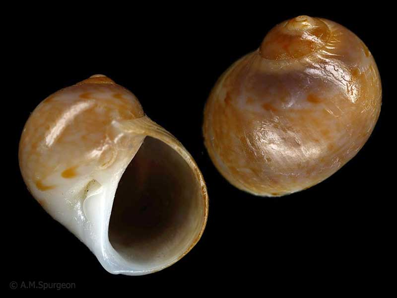
Hermit crab in rock pool, Karikari Peninsula, Northland, NZ. 19.5mm
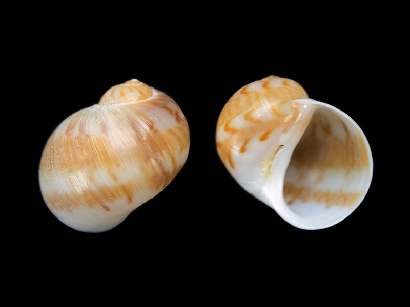
In beach drift, Taupiri Bay, Northland, NZ. 11mm
Hermit crab in rock pool, Karikari Peninsula, Northland, NZ. 19.5mm
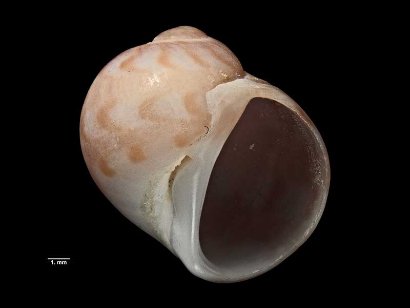
Holotype, collected off Urupukapuka Island, Bay of Islands, Northland, NZ (MA71330). © Auckland Museum (CC-BY)
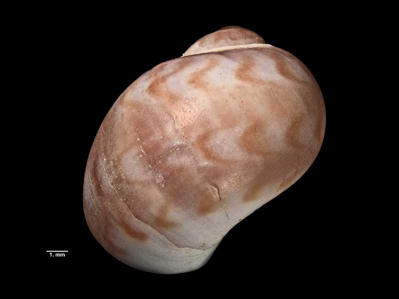
Holotype, collected off Urupukapuka Island, Bay of Islands, Northland, NZ (MA71330). © Auckland Museum (CC-BY)
Taxonomy
Family: Subfamily: NATICIDAE: NATICINAE Full Classification: Mollusca (Phylum) > Gastropoda (Class) > Caenogastropoda (Subclass) > Littorinimorpha (Order) > Naticoidea (Superfamily) > Naticidae (Family) > Naticinae (Subfamily) > Notocochlis (Genus) > cernica (Species) Synonymised Names: =Natica (Natica) cernica Jousseaume, 1874 =Natica cernica Jousseaume, 1874 =Natica jousseaumei Euthyme, 1885 =Natica nebulosa Schepman, 1909 =Natica ochrostigmata Rehder, 1980 =Notocochlis sagittata hancockae Powell, 1971 |
Details: Notocochlis cernica (Jousseaume, 1874)
Size/Grows to:
Height 20mm, Width 17mm
Distribution:
Central Indian Ocean to Eastern Australia and the Philippines. NZ, Northland to Auckland
Geographical Range:
KA
Notes:
Species Links
Distribution Map
References and Publications
- Spurgeon, A.M., Burch, K.W., Carson, K., Walton, K., Plaisted, J. Nov/2017 Notes on NZ Collected Species, Cookia, 29 (p.12)
- Torigoe, K., Inaba, A. 2011 Revision on the classification of Recent Naticidae, Bulletin of the Nishinomiya Shell Museum, 7 (p.100)
- Kabat, A.R. 2000 Results of the Rumphius Biohistorical Expedition to Ambon. Part 10. Mollusca, Gastropoda, Naticidae, Zoologische Mededelingen (Leiden), 73 (p.364)
- Powell, A.W.B. 1979 New Zealand Mollusca: Marine, Land and Freshwater Shells, Collins, Auckland (p.154)
- Grange, K.R. Mar/1972 Notes of Interest: Natica sagittata hancockae, Poirieria, 6(3) (p.58)
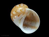
*98 © Museum of New Zealand Te Papa Tongarewa (CC-BY-NC-ND)
Key to Geographical Ranges

The symbols K.A.C.F.M.An. are used to indicate the geographical range of the species.
They have been adopted to give an approximation of the range of each species within New Zealand.
K=
Kermadec Islands
A=
Aupourian - Kaipara Harbour, north around North Cape, encompassing the Three Kings Islands and south to East Cape
C=
Cookian - Lower North Island and the northern part of the South Island
F=
Forsterian - Otago, Fiordland and Stewart Island
M=
Moriorian - Chatham Islands, Pitt Island
An=
Antipodean - Subantarctic Islands of New Zealand
Fw =
Freshwater
L =
Land
N =
North Island
S =
South Island
R =
Recent
Sf =
Subfossil
Fo =
Fossil
Compare Species (
/6)