Compare Epitonium jukesianum
| toggle to add to compare list |
Taxonomy
Family: EPITONIIDAE Full Classification: Mollusca (Phylum) > Gastropoda (Class) > Caenogastropoda (Subclass) > [unassigned] Caenogastropoda (Order) > Epitonioidea (Superfamily) > Epitoniidae (Family) > Epitonium (Genus) > jukesianum (Species) Synonymised Names: =Acutiscala ampacta Iredale, 1936 =Acutiscala fabia Iredale, 1936 =Clathrus fabia (Iredale, 1936) =Clathrus wellingtonensis (T.W. Kirk, 1880) =Epitonium (Hyaloscala) jukesianum (Forbes, 1852) accepted, alternate representation =Epitonium ampactum (Iredale, 1936) =Epitonium delicatulum (Crosse & Fischer, 1864) =Epitonium fabia (Iredale, 1936) =Epitonium wellingtonensis (T.W. Kirk, 1880) =Scalaria delicatula Crosse & Fischer, 1864 =Scalaria jukesiana Forbes, 1852 =Scalaria wellingtonensis T.W. Kirk, 1880 |
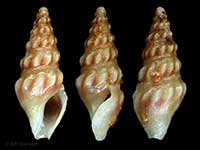
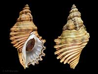
Images: Epitonium jukesianum (Forbes, 1852)
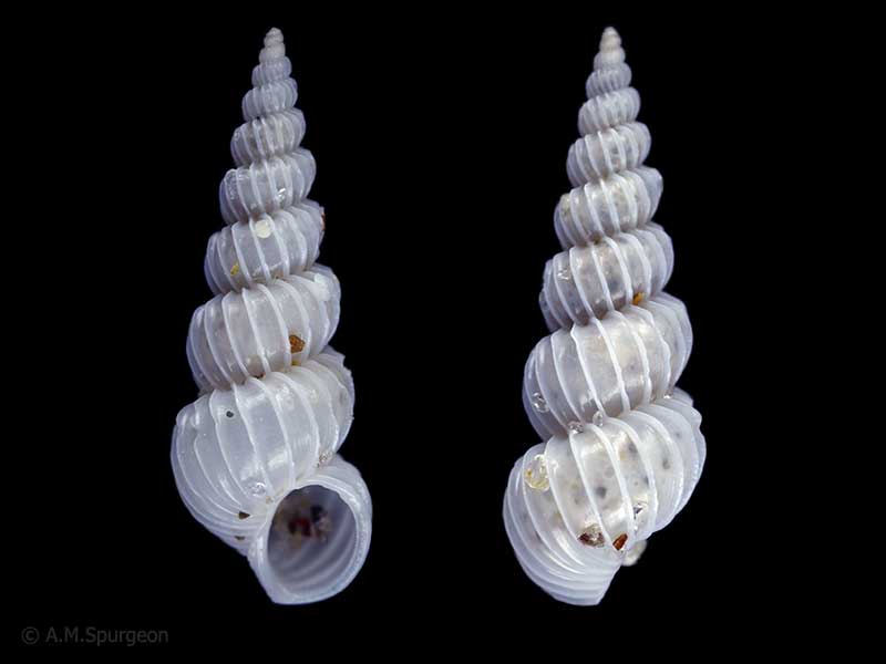
In beach drift, Uretiti Beach, Whangarei, Northland, NZ. 11mm
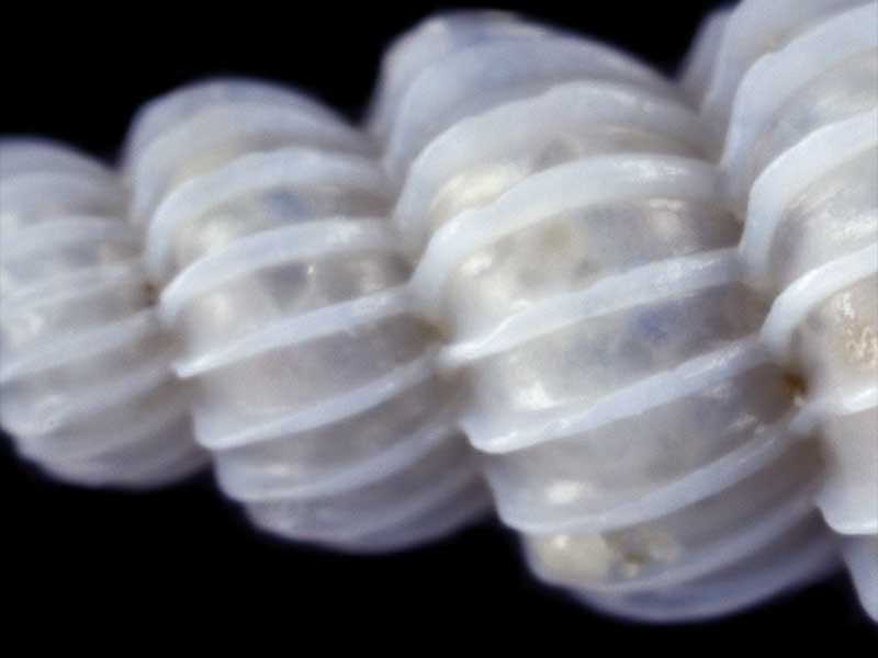
In beach drift, Uretiti Beach, Whangarei, Northland, NZ. Showing smooth areas in between varices. 11mm
Taxonomy
Family: EPITONIIDAE Full Classification: Mollusca (Phylum) > Gastropoda (Class) > Caenogastropoda (Subclass) > [unassigned] Caenogastropoda (Order) > Epitonioidea (Superfamily) > Epitoniidae (Family) > Epitonium (Genus) > jukesianum (Species) Synonymised Names: =Acutiscala ampacta Iredale, 1936 =Acutiscala fabia Iredale, 1936 =Clathrus fabia (Iredale, 1936) =Clathrus wellingtonensis (T.W. Kirk, 1880) =Epitonium (Hyaloscala) jukesianum (Forbes, 1852) accepted, alternate representation =Epitonium ampactum (Iredale, 1936) =Epitonium delicatulum (Crosse & Fischer, 1864) =Epitonium fabia (Iredale, 1936) =Epitonium wellingtonensis (T.W. Kirk, 1880) =Scalaria delicatula Crosse & Fischer, 1864 =Scalaria jukesiana Forbes, 1852 =Scalaria wellingtonensis T.W. Kirk, 1880 |
Details: Epitonium jukesianum (Forbes, 1852)
Size/Grows to:
Height 13mm, Width 4mm
Distribution:
North Island to Cook Strait. Also Tasmania and from New South Wales to Western Australia
Geographical Range:
AC
Notes:
Species Links
Distribution Map
References and Publications
- Powell, A.W.B. 1979 New Zealand Mollusca: Marine, Land and Freshwater Shells, Collins, Auckland (p.250)
*98 © Museum of New Zealand Te Papa Tongarewa (CC-BY-NC-ND)
Key to Geographical Ranges

The symbols K.A.C.F.M.An. are used to indicate the geographical range of the species.
They have been adopted to give an approximation of the range of each species within New Zealand.
K=
Kermadec Islands
A=
Aupourian - Kaipara Harbour, north around North Cape, encompassing the Three Kings Islands and south to East Cape
C=
Cookian - Lower North Island and the northern part of the South Island
F=
Forsterian - Otago, Fiordland and Stewart Island
M=
Moriorian - Chatham Islands, Pitt Island
An=
Antipodean - Subantarctic Islands of New Zealand
Fw =
Freshwater
L =
Land
N =
North Island
S =
South Island
R =
Recent
Sf =
Subfossil
Fo =
Fossil

Compare Species (
/6)