Compare Cominella quoyana
| toggle to add to compare list |
Taxonomy
Family: COMINELLIDAE Full Classification: Mollusca (Phylum) > Gastropoda (Class) > Caenogastropoda (Subclass) > Neogastropoda (Order) > Buccinoidea (Superfamily) > Cominellidae (Family) > Cominella (Genus) > quoyana (Species) Synonymised Names: =Buccinum luridum Hutton, 1873 =Cominella (Cominula) kempi Powell, 1934 =Cominella (Cominula) quoyana A. Adams, 1855 =Cominella (Josepha) quoyana A. Adams, 1855 =Cominella (Josepha) quoyana quoyana A. Adams, 1855 =Cominella huttoni Kobelt, 1878 =Cominella quoyana quoyana A. Adams, 1855 |
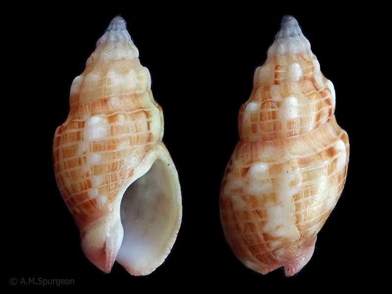
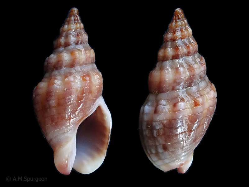
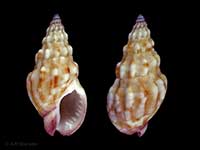
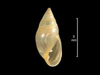
Images: Cominella quoyana A. Adams, 1854
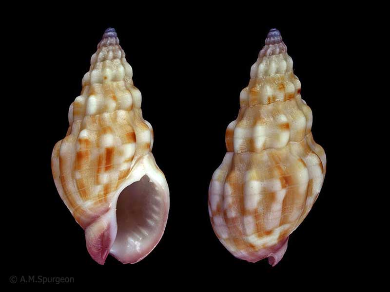
From off the Aldermen Islands. 21mm
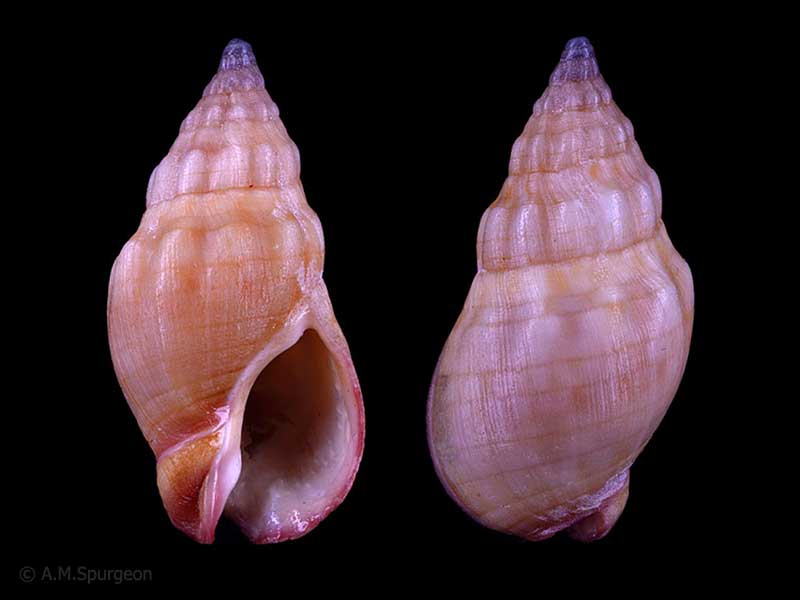
(youngi form) - From the Far North. 21mm
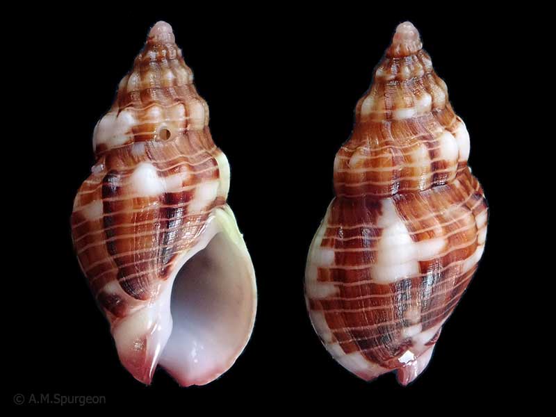
Hermit crab in rock pool, Rarawa, Far North, NZ. 21mm
Hermit crab in rock pool, Rarawa, Far North, NZ. 19mm
Hermit crab in rock pool, Rarawa, Far North, NZ. 24mm
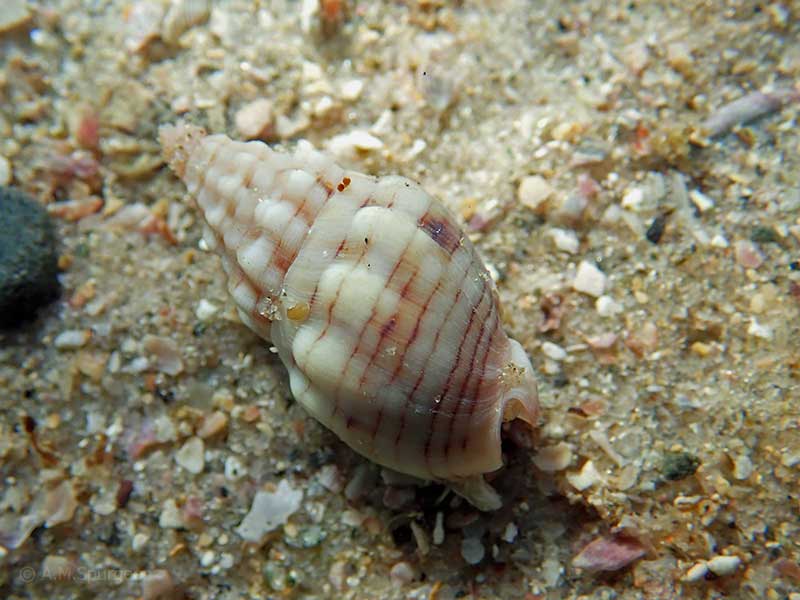
Below low tide on sand, Henderson Bay, Far North, NZ. 20mm
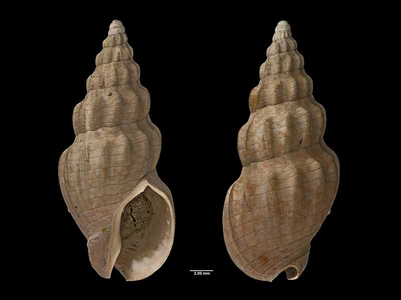
Holotype of Cominella (Cominula) kempi Powell, 1934, collected east of Whangaparaoa Bay, Cape Runaway, East Cape, NZ (MA70187). © Auckland Museum (CC-BY)
Taxonomy
Family: COMINELLIDAE Full Classification: Mollusca (Phylum) > Gastropoda (Class) > Caenogastropoda (Subclass) > Neogastropoda (Order) > Buccinoidea (Superfamily) > Cominellidae (Family) > Cominella (Genus) > quoyana (Species) Synonymised Names: =Buccinum luridum Hutton, 1873 =Cominella (Cominula) kempi Powell, 1934 =Cominella (Cominula) quoyana A. Adams, 1855 =Cominella (Josepha) quoyana A. Adams, 1855 =Cominella (Josepha) quoyana quoyana A. Adams, 1855 =Cominella huttoni Kobelt, 1878 =Cominella quoyana quoyana A. Adams, 1855 |
Details: Cominella quoyana A. Adams, 1854
Size/Grows to:
Height 26mm, Width 11mm
Distribution:
Northern part of North Island to Mahia
Geographical Range:
AC
Notes:
Species Links
Distribution Map
References and Publications
- Powell, A.W.B. 1979 New Zealand Mollusca: Marine, Land and Freshwater Shells, Collins, Auckland (p.193)
*98 © Museum of New Zealand Te Papa Tongarewa (CC-BY-NC-ND)
Key to Geographical Ranges

The symbols K.A.C.F.M.An. are used to indicate the geographical range of the species.
They have been adopted to give an approximation of the range of each species within New Zealand.
K=
Kermadec Islands
A=
Aupourian - Kaipara Harbour, north around North Cape, encompassing the Three Kings Islands and south to East Cape
C=
Cookian - Lower North Island and the northern part of the South Island
F=
Forsterian - Otago, Fiordland and Stewart Island
M=
Moriorian - Chatham Islands, Pitt Island
An=
Antipodean - Subantarctic Islands of New Zealand
Fw =
Freshwater
L =
Land
N =
North Island
S =
South Island
R =
Recent
Sf =
Subfossil
Fo =
Fossil
Recently Viewed
Compare Species (
/6)