Compare Neoguraleus sandersonae
| toggle to add to compare list |
Taxonomy
Family: MANGELIIDAE Full Classification: Mollusca (Phylum) > Gastropoda (Class) > Caenogastropoda (Subclass) > Neogastropoda (Order) > Conoidea (Superfamily) > Mangeliidae (Family) > Neoguraleus (Genus) > sandersonae (Species) Synonymised Names: =Scrinium sandersonae Bucknill, 1927 |
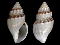
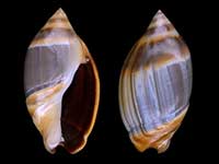
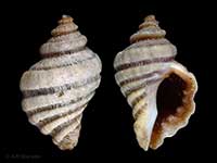
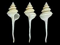
Images: Neoguraleus sandersonae (Bucknill, 1927)
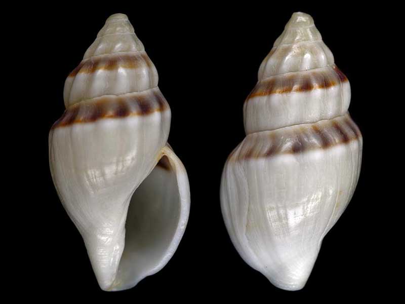
Washed up, near Bay of Islands, Northland, NZ. 14mm
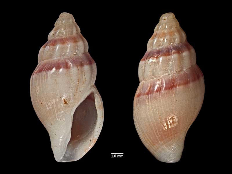
Holotype of Scrinium sandersonae Buckill, 1927, Matauri Bay, NZ (MA70702). © Auckland Museum (CC-BY)
Taxonomy
Family: MANGELIIDAE Full Classification: Mollusca (Phylum) > Gastropoda (Class) > Caenogastropoda (Subclass) > Neogastropoda (Order) > Conoidea (Superfamily) > Mangeliidae (Family) > Neoguraleus (Genus) > sandersonae (Species) Synonymised Names: =Scrinium sandersonae Bucknill, 1927 |
Details: Neoguraleus sandersonae (Bucknill, 1927)
Size/Grows to:
Height 15mm, Width 7mm
Distribution:
North-eastern North Island as far south as Mahia Peninsula
Geographical Range:
A
Notes:
Species Links
Distribution Map
References and Publications
- Powell, A.W.B. 1979 New Zealand Mollusca: Marine, Land and Freshwater Shells, Collins, Auckland (p.238)
- Powell, A.W.B. 1942 The New Zealand Recent and fossil Mollusca of the family Turridae with general notes on turrid nomenclature and systematics, Auckland Institute and Museum Bulletin, 2 (p.136)
- Bucknill 1927 Description of two new species of marine Gasteropod, Transactions and Proceedings of the New Zealand Institute, 58 (p.311) Original Description
Key to Geographical Ranges

The symbols K.A.C.F.M.An. are used to indicate the geographical range of the species.
They have been adopted to give an approximation of the range of each species within New Zealand.
K=
Kermadec Islands
A=
Aupourian - Kaipara Harbour, north around North Cape, encompassing the Three Kings Islands and south to East Cape
C=
Cookian - Lower North Island and the northern part of the South Island
F=
Forsterian - Otago, Fiordland and Stewart Island
M=
Moriorian - Chatham Islands, Pitt Island
An=
Antipodean - Subantarctic Islands of New Zealand
Fw =
Freshwater
L =
Land
N =
North Island
S =
South Island
R =
Recent
Sf =
Subfossil
Fo =
Fossil
Compare Species (
/6)