Compare Hydatina physis
| toggle to add to compare list |
Taxonomy
Family: APLUSTRIDAE Full Classification: Mollusca (Phylum) > Gastropoda (Class) > Heterobranchia (Subclass) > Euthyneura (Infraclass) > Acteonimorpha (Subterclass) > Acteonoidea (Superfamily) > Aplustridae (Family) > Hydatina (Genus) > physis (Species) Genus Synonyms: =Hydatoria Iredale, 1936 Synonymised Names: =Bulla atrolineata Schröter, 1804 =Bulla physis Linnaeus, 1758 =Bulla quoyana d'Orbigny, 1845 =Bulla staminea Menke, 1853 =Hydatina filosa Schumacher, 1817 |
Images: Hydatina physis (Linnaeus, 1758)
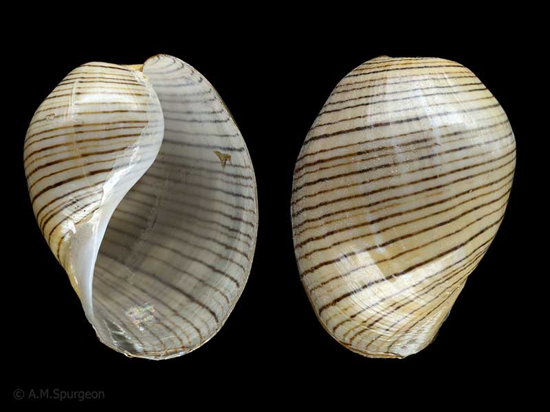
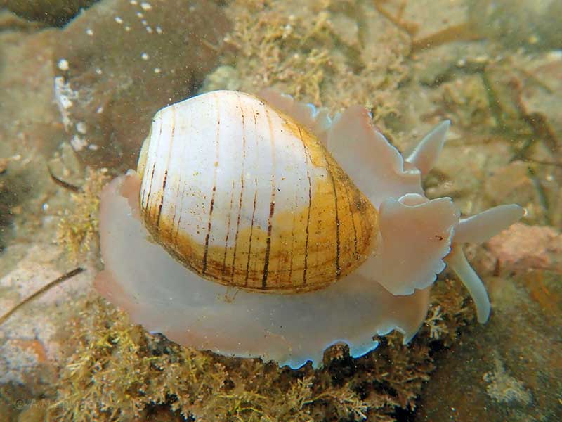
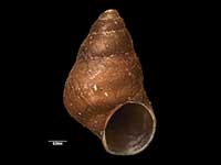
Rangiputa, Northland, NZ. 34mm
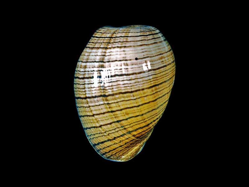
A fragile Gastropod found occasionally off the Northland Coast
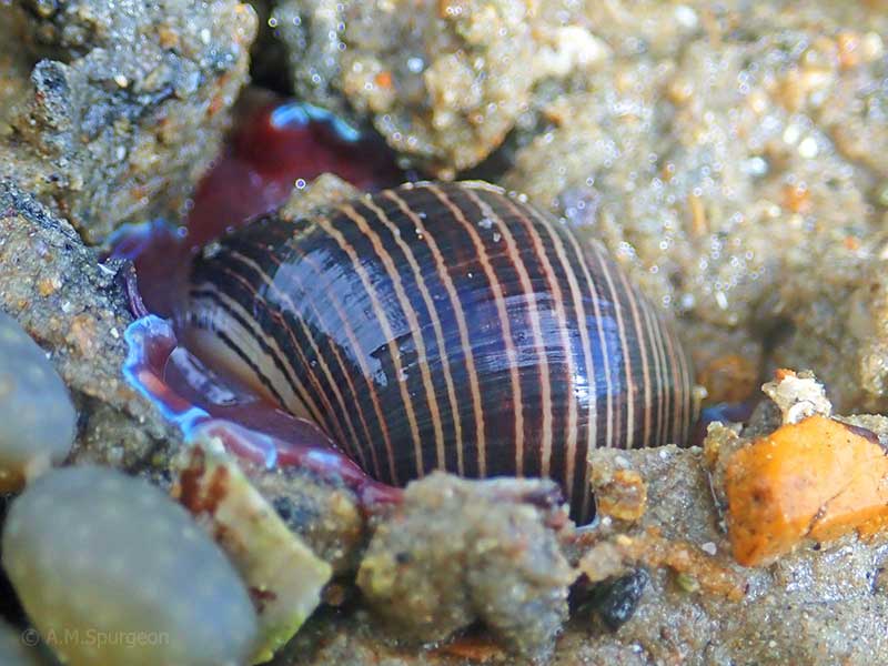
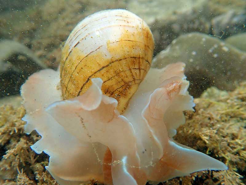
At low tide, buried in silty sand, Houhora Heads, Far North, NZ. ~60mm (animal)
At low tide, buried in silty sand, Houhora Heads, Far North, NZ. ~60mm (animal)
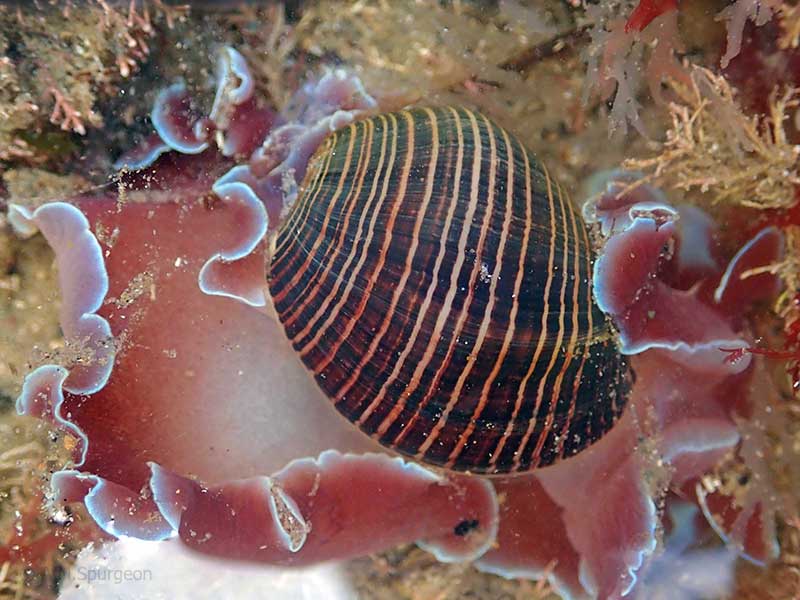
Below low tide, Houhora Heads, Far North, NZ. 60-70mm (animal)
Below low tide, Houhora Heads, Far North, NZ. 60-70mm (animal)
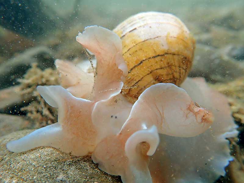
Below low tide, Houhora Heads, Far North, NZ. 60-70mm (animal)

Below low tide, Houhora Heads, Far North, NZ. 60-70mm (animal)
Taxonomy
Family: APLUSTRIDAE Full Classification: Mollusca (Phylum) > Gastropoda (Class) > Heterobranchia (Subclass) > Euthyneura (Infraclass) > Acteonimorpha (Subterclass) > Acteonoidea (Superfamily) > Aplustridae (Family) > Hydatina (Genus) > physis (Species) Genus Synonyms: =Hydatoria Iredale, 1936 Synonymised Names: =Bulla atrolineata Schröter, 1804 =Bulla physis Linnaeus, 1758 =Bulla quoyana d'Orbigny, 1845 =Bulla staminea Menke, 1853 =Hydatina filosa Schumacher, 1817 |
Details: Hydatina physis (Linnaeus, 1758)
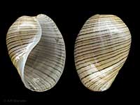
Size/Grows to:
Height 60mm, 50mm
Distribution:
Worldwide in warm seas. Northland east coast to Coromandel
Geographical Range:
KA
Notes:
Species Links
Distribution Map
References and Publications
- Morley, M.S., Hayward, B.W. 2015 Intertidal records of 'sea slugs' (nudibranchs and allied opisthobranch gastropods) from northern North Island, New Zealand, Records of the Auckland Institute and Museum, 50 (p.53)
- Raven, J.L. Nov/2011 Notes on New Zealand collected species, Cookia, 23 (p.18)
- Hayward, B.W., Stephenson, A.B., Morley, M.S., Blom, W.M., Grenfell, H.R., Brook, F.J., Riley, J.L., Thompson, F., Hayward, J.J. 2001 Marine biota of Parengarenga Harbour, Northland, New Zealand, Records of the Auckland Institute and Museum, 37 (p.62)
- Brook, F.J., Marshall, B.A. 1998 The coastal molluscan fauna of the northern Kermadec Islands, southwest Pacific Ocean, Journal of the Royal Society of New Zealand, 28 (p.230)
- May/1979 Notes of Interest: Hydatina physis (Linnaeus, 1758), Poirieria, 10(2)
- Powell, A.W.B. 1979 New Zealand Mollusca: Marine, Land and Freshwater Shells, Collins, Auckland (p.270)
Key to Geographical Ranges

The symbols K.A.C.F.M.An. are used to indicate the geographical range of the species.
They have been adopted to give an approximation of the range of each species within New Zealand.
K=
Kermadec Islands
A=
Aupourian - Kaipara Harbour, north around North Cape, encompassing the Three Kings Islands and south to East Cape
C=
Cookian - Lower North Island and the northern part of the South Island
F=
Forsterian - Otago, Fiordland and Stewart Island
M=
Moriorian - Chatham Islands, Pitt Island
An=
Antipodean - Subantarctic Islands of New Zealand
Fw =
Freshwater
L =
Land
N =
North Island
S =
South Island
R =
Recent
Sf =
Subfossil
Fo =
Fossil
Compare Species (
/6)