Compare Maoristylus ambagiosus priscus
| toggle to add to compare list |
Taxonomy
Family: Subfamily: BOTHRIEMBRYONTIDAE: PLACOSTYLINAE Full Classification: Mollusca (Phylum) > Gastropoda (Class) > Heterobranchia (Subclass) > Euthyneura (Infraclass) > Tectipleura (Subterclass) > Eupulmonata (Superorder) > Stylommatophora (Order) > Helicina (Suborder) > Orthalicoidei (Infraorder) > Orthalicoidea (Superfamily) > Bothriembryontidae (Family) > Placostylinae (Subfamily) > Maoristylus (Genus) > ambagiosus priscus (Species) Genus Synonyms: =Bulimus (Placostylus) H. Beck, 1837 =Placostylus (Euplacostylus) Crosse, 1875 =Placostylus (Maoristylus) Haas, 1935 Synonymised Names: =Placostylus (Maoristylus) ambagiosus priscus Powell, 1938 |
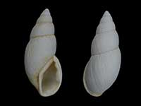
Images: Maoristylus ambagiosus priscus Powell, 1938
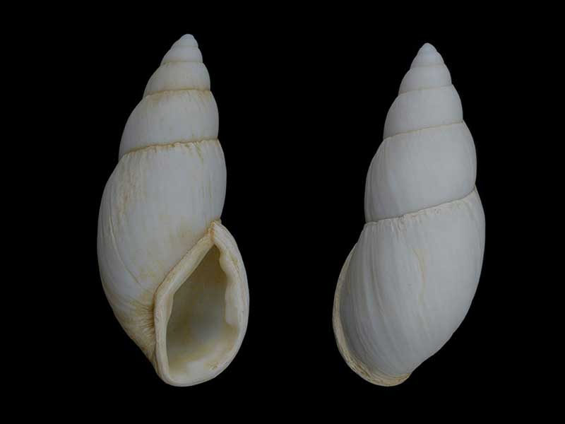
Sub-fossil from sand dunes at Cape Maria van Diemen. 75mm. Photographed from an old collection, pre 1970's
Taxonomy
Family: Subfamily: BOTHRIEMBRYONTIDAE: PLACOSTYLINAE Full Classification: Mollusca (Phylum) > Gastropoda (Class) > Heterobranchia (Subclass) > Euthyneura (Infraclass) > Tectipleura (Subterclass) > Eupulmonata (Superorder) > Stylommatophora (Order) > Helicina (Suborder) > Orthalicoidei (Infraorder) > Orthalicoidea (Superfamily) > Bothriembryontidae (Family) > Placostylinae (Subfamily) > Maoristylus (Genus) > ambagiosus priscus (Species) Genus Synonyms: =Bulimus (Placostylus) H. Beck, 1837 =Placostylus (Euplacostylus) Crosse, 1875 =Placostylus (Maoristylus) Haas, 1935 Synonymised Names: =Placostylus (Maoristylus) ambagiosus priscus Powell, 1938 |
Details: Maoristylus ambagiosus priscus Powell, 1938
Size/Grows to:
Height 84mm, Width 33mm
Distribution:
Cape Maria van Diemen, Far North
Geographical Range:
L.N.Sf.
Notes:
Species Links
Distribution Map
References and Publications
- Powell, A.W.B. 1979 New Zealand Mollusca: Marine, Land and Freshwater Shells, Collins, Auckland (p.351)
- Powell, A.W.B. 1951 On further colonies of Placostylus land snails from northernmost New Zealand, Records of the Auckland Institute and Museum, 4(2) (p.139)
- Powell, A.W.B. 1938 The Paryphantidae of New Zealand No. 4 and the Genus Placostylus in New Zealand, Records of the Auckland Institute and Museum, 2 (p.149) Original Description
Key to Geographical Ranges

The symbols K.A.C.F.M.An. are used to indicate the geographical range of the species.
They have been adopted to give an approximation of the range of each species within New Zealand.
K=
Kermadec Islands
A=
Aupourian - Kaipara Harbour, north around North Cape, encompassing the Three Kings Islands and south to East Cape
C=
Cookian - Lower North Island and the northern part of the South Island
F=
Forsterian - Otago, Fiordland and Stewart Island
M=
Moriorian - Chatham Islands, Pitt Island
An=
Antipodean - Subantarctic Islands of New Zealand
Fw =
Freshwater
L =
Land
N =
North Island
S =
South Island
R =
Recent
Sf =
Subfossil
Fo =
Fossil
Compare Species (
/6)