Compare Paryphanta watti
| toggle to add to compare list |
Taxonomy
Family: Subfamily: RHYTIDIDAE: RHYTIDINAE Full Classification: Mollusca (Phylum) > Gastropoda (Class) > Heterobranchia (Subclass) > Euthyneura (Infraclass) > Tectipleura (Subterclass) > Eupulmonata (Superorder) > Stylommatophora (Order) > Helicina (Suborder) > Rhytidoidei (Infraorder) > Rhytidoidea (Superfamily) > Rhytididae (Family) > Rhytidinae (Subfamily) > Paryphanta (Genus) > watti (Species) Genus Synonyms: =Helix (Paryphanta) Albers, 1850 Synonymised Names: =Paryphanta busbyi watti Powell, 1946 |
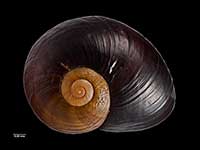
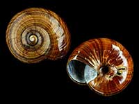
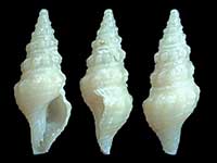
Images: Paryphanta watti Powell, 1946

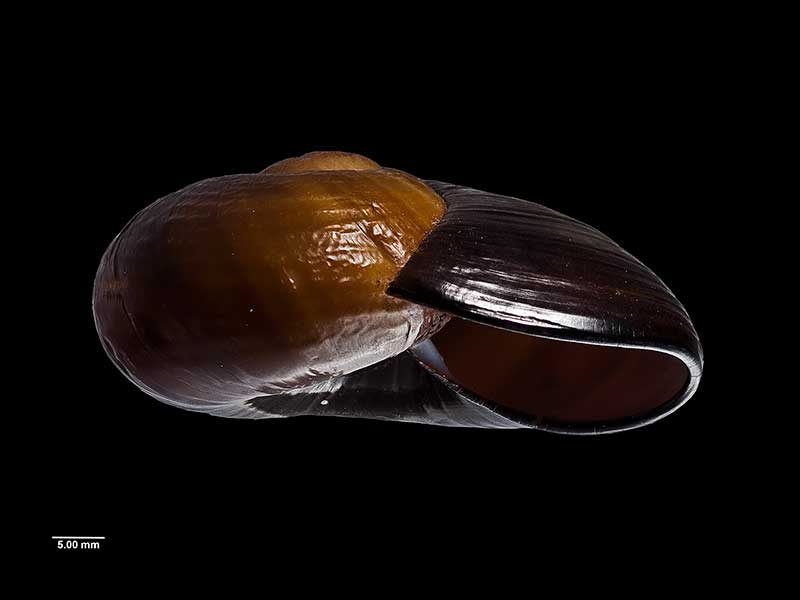
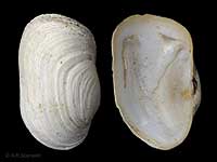
Holotype, collected Feb 1934, Mt. Unuwhao, Far North, NZ (MA71087). © Auckland Museum (CC-BY)
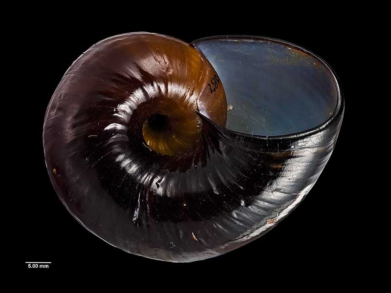
Holotype, collected Feb 1934, Mt. Unuwhao, Far North, NZ (MA71087). © Auckland Museum (CC-BY)
Holotype, collected Feb 1934, Mt. Unuwhao, Far North, NZ (MA71087). © Auckland Museum (CC-BY)
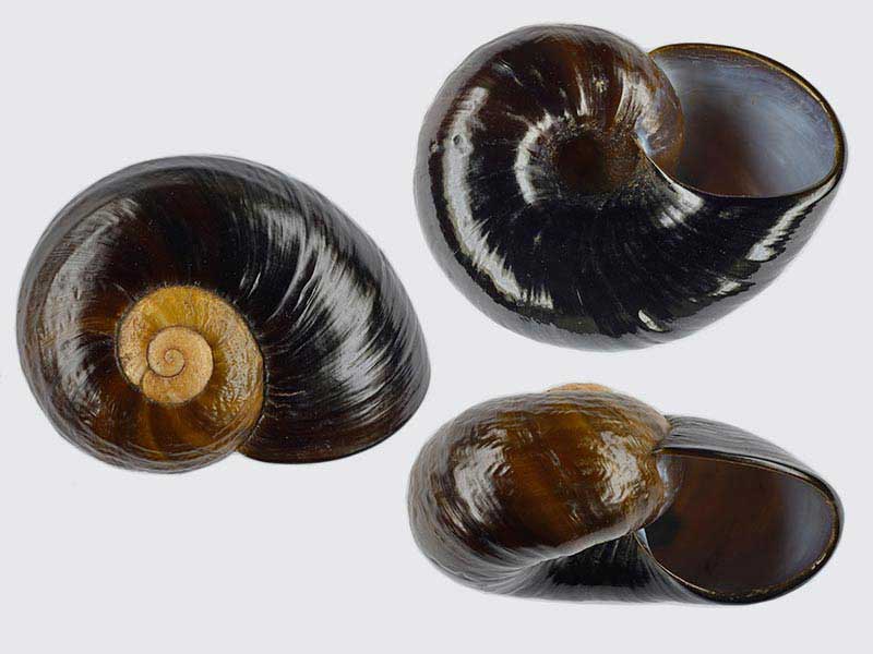
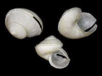
From the Far North, NZ. 56mm. Photographed from an old collection, pre 1970's
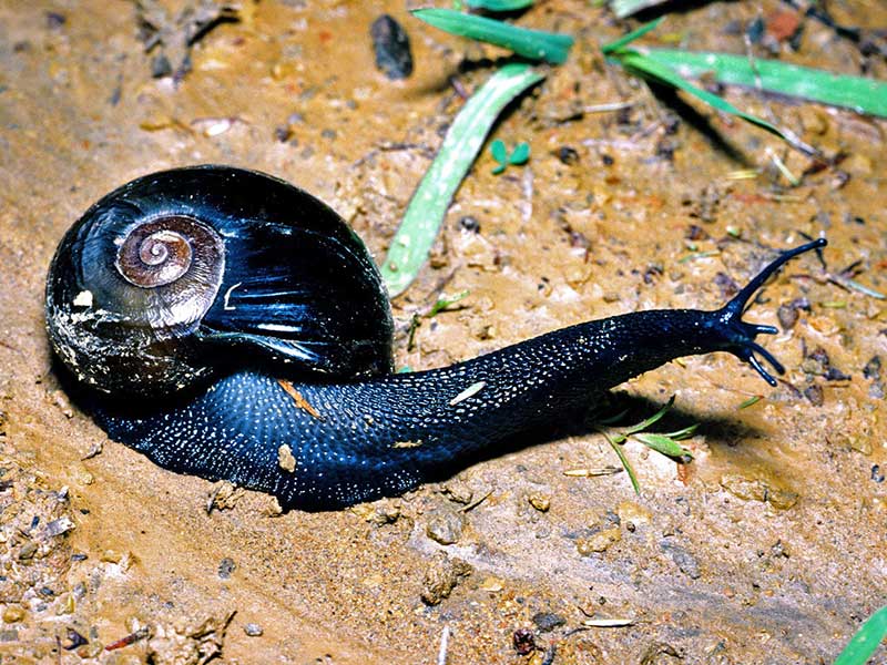
Far North, NZ
Taxonomy
Family: Subfamily: RHYTIDIDAE: RHYTIDINAE Full Classification: Mollusca (Phylum) > Gastropoda (Class) > Heterobranchia (Subclass) > Euthyneura (Infraclass) > Tectipleura (Subterclass) > Eupulmonata (Superorder) > Stylommatophora (Order) > Helicina (Suborder) > Rhytidoidei (Infraorder) > Rhytidoidea (Superfamily) > Rhytididae (Family) > Rhytidinae (Subfamily) > Paryphanta (Genus) > watti (Species) Genus Synonyms: =Helix (Paryphanta) Albers, 1850 Synonymised Names: =Paryphanta busbyi watti Powell, 1946 |
Details: Paryphanta watti Powell, 1946
Size/Grows to:
Length 62mm, Height 23mm
Distribution:
Far North. Cape Maria van Diemen to North Cape block
Geographical Range:
L.N.R.Sf.
Notes:
Species Links
Distribution Map
References and Publications
- Spencer, H.G., Brook, F.J., Kennedy, M. 2006 Phylogeography of Kauri Snails and their allies from Northland, New Zealand, Molecular Phylogenetics and Evolution, 38 (p.835)
- Powell, A.W.B. 1979 New Zealand Mollusca: Marine, Land and Freshwater Shells, Collins, Auckland (p.335)
- Powell, A.W.B. 1946 The Paryphantidae of New Zealand. No. 5. Further new species of Paryphanta, Wainuia and Rhytida, Records of the Auckland Institute and Museum, 3 (p.101) Original Description
Key to Geographical Ranges

The symbols K.A.C.F.M.An. are used to indicate the geographical range of the species.
They have been adopted to give an approximation of the range of each species within New Zealand.
K=
Kermadec Islands
A=
Aupourian - Kaipara Harbour, north around North Cape, encompassing the Three Kings Islands and south to East Cape
C=
Cookian - Lower North Island and the northern part of the South Island
F=
Forsterian - Otago, Fiordland and Stewart Island
M=
Moriorian - Chatham Islands, Pitt Island
An=
Antipodean - Subantarctic Islands of New Zealand
Fw =
Freshwater
L =
Land
N =
North Island
S =
South Island
R =
Recent
Sf =
Subfossil
Fo =
Fossil
Compare Species (
/6)