Compare Therasiella tamora
| toggle to add to compare list |
Taxonomy
Family: Subfamily: CHAROPIDAE: CHAROPINAE Full Classification: Mollusca (Phylum) > Gastropoda (Class) > Heterobranchia (Subclass) > Euthyneura (Infraclass) > Tectipleura (Subterclass) > Eupulmonata (Superorder) > Stylommatophora (Order) > Helicina (Suborder) > [unassigned] Helicina (Infraorder) > Punctoidea (Superfamily) > Charopidae (Family) > Charopinae (Subfamily) > Therasiella (Genus) > tamora (Species) Synonymised Names: =Therasia tamora Hutton, 1883 |
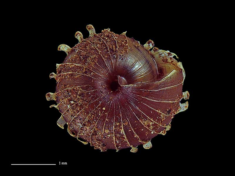
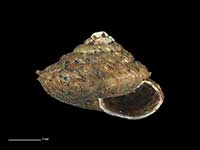
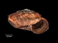
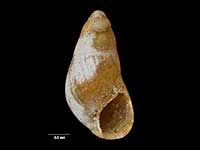
Images: Therasiella tamora (Hutton, 1883)

Great Mercury Island, Bay of Plenty. 4.1mm. Reproduced courtesy of iNaturalist.nz ©openlabnz (D.J.Roscoe)
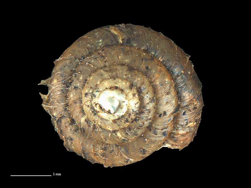
Great Mercury Island, Bay of Plenty. 4.1mm. Reproduced courtesy of iNaturalist.nz ©openlabnz (D.J.Roscoe)
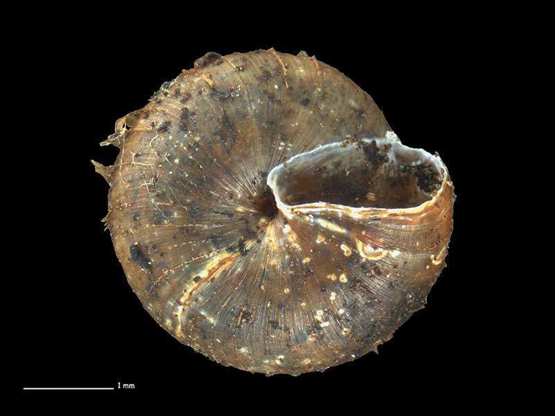
Great Mercury Island, Bay of Plenty. 4.1mm. Reproduced courtesy of iNaturalist.nz ©openlabnz (D.J.Roscoe)
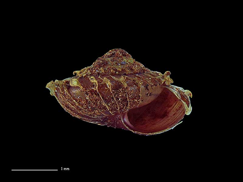
Collected May 2018, Mt. Pirongia, Waikato, NZ. 3.1mm. Reproduced courtesy of Dave Roscoe
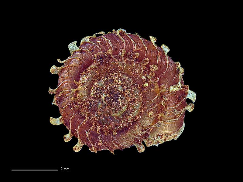
Collected May 2018, Mt. Pirongia, Waikato, NZ. 3.1mm. Reproduced courtesy of Dave Roscoe
Collected May 2018, Mt. Pirongia, Waikato, NZ. 3.1mm. Reproduced courtesy of Dave Roscoe
Taxonomy
Family: Subfamily: CHAROPIDAE: CHAROPINAE Full Classification: Mollusca (Phylum) > Gastropoda (Class) > Heterobranchia (Subclass) > Euthyneura (Infraclass) > Tectipleura (Subterclass) > Eupulmonata (Superorder) > Stylommatophora (Order) > Helicina (Suborder) > [unassigned] Helicina (Infraorder) > Punctoidea (Superfamily) > Charopidae (Family) > Charopinae (Subfamily) > Therasiella (Genus) > tamora (Species) Synonymised Names: =Therasia tamora Hutton, 1883 |
Details: Therasiella tamora (Hutton, 1883)
Size/Grows to:
Width 5mm, Height 3mm
Distribution:
North Island. Northland to Te Awamutu and Coromandel
Geographical Range:
L.N.
Notes:
Species Links
Distribution Map
References and Publications
- Powell, A.W.B. 1979 New Zealand Mollusca: Marine, Land and Freshwater Shells, Collins, Auckland (p.312)
- Cumber, R.A. 1967 The Genus Therasiella (Mollusca: Flammulinidae) in the North Island Mainland with descriptions of three new species, Transactions of the Royal Society of New Zealand, 10(7) (p.67)
- Hutton, F.W. 1883 Notes on some New Zealand land shells, New Zealand Journal of Science, 1(10) (p.477) Original Description
Key to Geographical Ranges

The symbols K.A.C.F.M.An. are used to indicate the geographical range of the species.
They have been adopted to give an approximation of the range of each species within New Zealand.
K=
Kermadec Islands
A=
Aupourian - Kaipara Harbour, north around North Cape, encompassing the Three Kings Islands and south to East Cape
C=
Cookian - Lower North Island and the northern part of the South Island
F=
Forsterian - Otago, Fiordland and Stewart Island
M=
Moriorian - Chatham Islands, Pitt Island
An=
Antipodean - Subantarctic Islands of New Zealand
Fw =
Freshwater
L =
Land
N =
North Island
S =
South Island
R =
Recent
Sf =
Subfossil
Fo =
Fossil
Compare Species (
/6)