Compare Laomarex minuta
| toggle to add to compare list |
Taxonomy
Family: Subfamily: PUNCTIDAE: LAOMINAE Full Classification: Mollusca (Phylum) > Gastropoda (Class) > Heterobranchia (Subclass) > Euthyneura (Infraclass) > Tectipleura (Subterclass) > Eupulmonata (Superorder) > Stylommatophora (Order) > Helicina (Suborder) > [unassigned] Helicina (Infraorder) > Punctoidea (Superfamily) > Punctidae (Family) > Laominae (Subfamily) > Laomarex (Genus) > minuta (Species) Synonymised Names: =Thalassohelix minuta Gardner, 1967 |
Images: Laomarex minuta (Gardner, 1967)
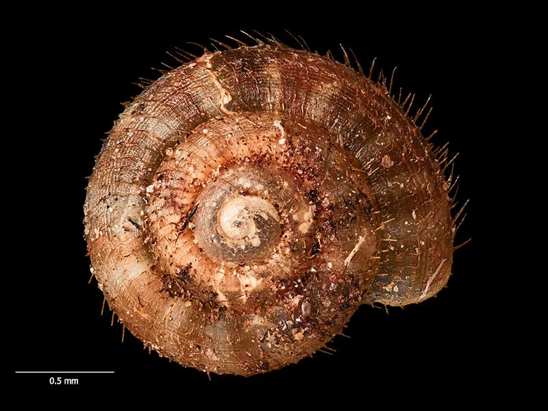
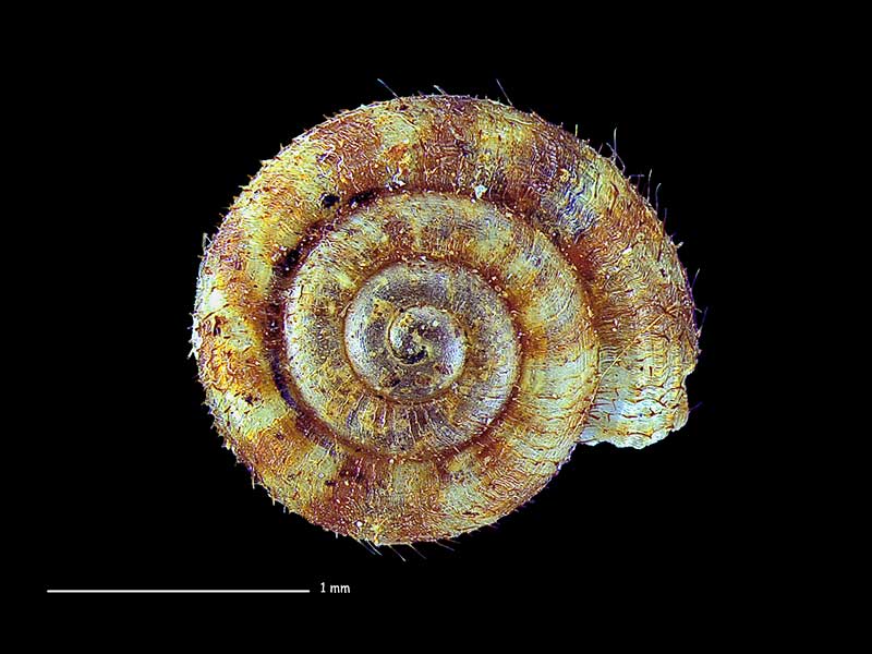
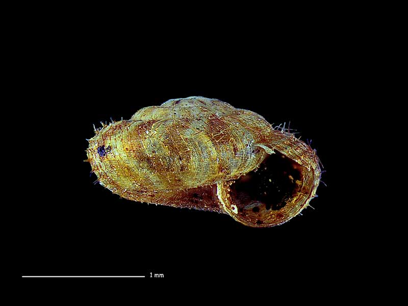
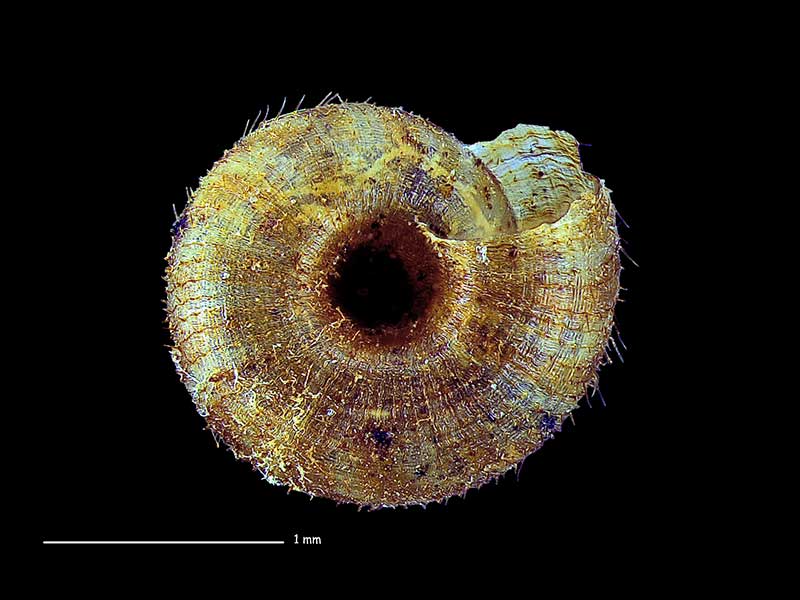
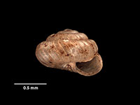
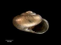
Holotype of Thalassohelix minuta Gardner, 1967, Tapotupotu Bay, E of Cape Reinga, Far North, NZ (MA71298). 2.5mm. © Auckland Museum (CC-BY)
Holotype of Thalassohelix minuta Gardner, 1967, Tapotupotu Bay, E of Cape Reinga, Far North, NZ (MA71298). 2.5mm. © Auckland Museum (CC-BY)
Holotype of Thalassohelix minuta Gardner, 1967, Tapotupotu Bay, E of Cape Reinga, Far North, NZ (MA71298). 2.5mm. © Auckland Museum (CC-BY)
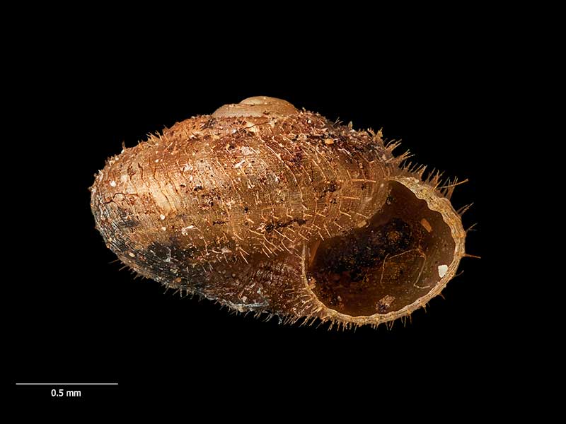
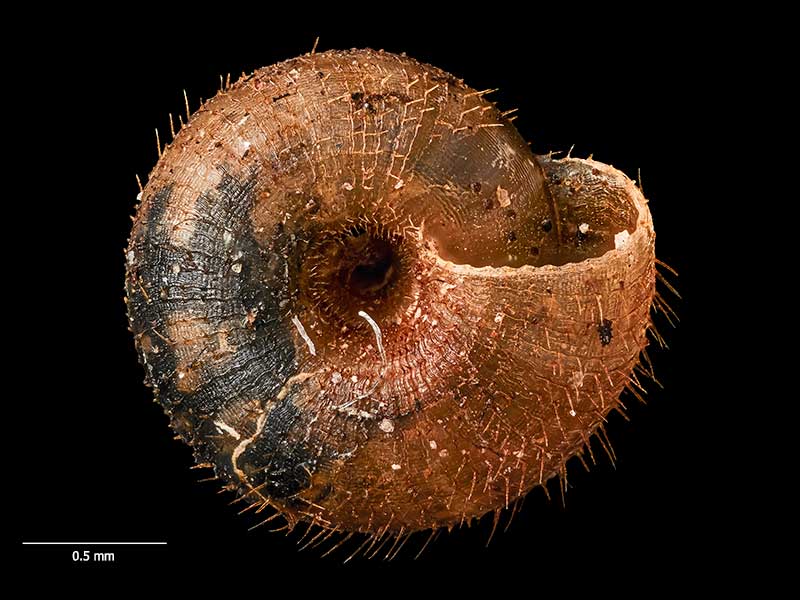
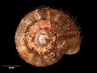
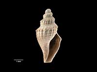
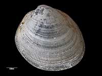
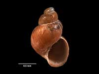
Collected Jan 1975, Tapotupotu Bay, E of Cape Reinga, Far North, NZ. 2.0mm. Reproduced courtesy of Dave Roscoe
Collected Jan 1975, Tapotupotu Bay, E of Cape Reinga, Far North, NZ. 2.0mm. Reproduced courtesy of Dave Roscoe
Collected Jan 1975, Tapotupotu Bay, E of Cape Reinga, Far North, NZ. 2.0mm. Reproduced courtesy of Dave Roscoe
Taxonomy
Family: Subfamily: PUNCTIDAE: LAOMINAE Full Classification: Mollusca (Phylum) > Gastropoda (Class) > Heterobranchia (Subclass) > Euthyneura (Infraclass) > Tectipleura (Subterclass) > Eupulmonata (Superorder) > Stylommatophora (Order) > Helicina (Suborder) > [unassigned] Helicina (Infraorder) > Punctoidea (Superfamily) > Punctidae (Family) > Laominae (Subfamily) > Laomarex (Genus) > minuta (Species) Synonymised Names: =Thalassohelix minuta Gardner, 1967 |
Details: Laomarex minuta (Gardner, 1967)
Size/Grows to:
Width 2.5mm, Height 1mm
Distribution:
North Island. Cape Reinga to Spirits Bay, Far North
Geographical Range:
L.N.
Notes:
Species Links
Distribution Map
References and Publications
- Goulstone, J.F., Mayhill, P.C., Parrish, G.R. 1993 An Illustrated Guide to the Land Mollusca of the Te Paki ecological region, Northland, New Zealand, New Zealand Journal of Zoology, 34 (p.23)
- Powell, A.W.B. 1979 New Zealand Mollusca: Marine, Land and Freshwater Shells, Collins, Auckland (p.332)
- Gardner, N.W. 1967 Descriptions of six new species of Land Snails from the Far North of New Zealand, Transactions of the Royal Society of New Zealand, 8(21) (p.216) Original Description
Key to Geographical Ranges

The symbols K.A.C.F.M.An. are used to indicate the geographical range of the species.
They have been adopted to give an approximation of the range of each species within New Zealand.
K=
Kermadec Islands
A=
Aupourian - Kaipara Harbour, north around North Cape, encompassing the Three Kings Islands and south to East Cape
C=
Cookian - Lower North Island and the northern part of the South Island
F=
Forsterian - Otago, Fiordland and Stewart Island
M=
Moriorian - Chatham Islands, Pitt Island
An=
Antipodean - Subantarctic Islands of New Zealand
Fw =
Freshwater
L =
Land
N =
North Island
S =
South Island
R =
Recent
Sf =
Subfossil
Fo =
Fossil
Compare Species (
/6)