Compare Hiatula nitida
| toggle to add to compare list |
Taxonomy
Family: PSAMMOBIIDAE Full Classification: Mollusca (Phylum) > Bivalvia (Class) > Autobranchia (Subclass) > Heteroconchia (Infraclass) > Euhetrodonta (Subterclass) > Imparidentia (Superorder) > Cardiida (Order) > Tellinoidea (Superfamily) > Psammobiidae (Family) > Hiatula (Genus) > nitida (Species) Genus Synonyms: =Hiatula (Hiatula) Modeer, 1793 =Psammotella H. & A. Adams, 1856 =Sanguinolaria (Soletellina) Blainville, 1824 =Solenotellina P. Fischer, 1887 =Soletellina Blainville, 1824 Synonymised Names: =Psammobia nitida Gray, 1843 =Soletellina nitida Reeve, 1857 =Soletellina nitida (Gray, 1843) =Soletellina siliqua Reeve, 1857 |
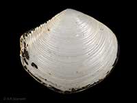
Images: Hiatula nitida (Gray, 1843)
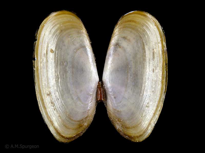
In beach drift, Ngunguru, Whangarei, Northland, NZ. 39mm
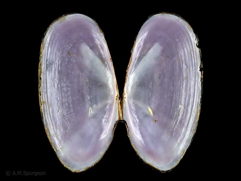
In beach drift, Ngunguru, Whangarei, Northland, NZ. 39mm
Taxonomy
Family: PSAMMOBIIDAE Full Classification: Mollusca (Phylum) > Bivalvia (Class) > Autobranchia (Subclass) > Heteroconchia (Infraclass) > Euhetrodonta (Subterclass) > Imparidentia (Superorder) > Cardiida (Order) > Tellinoidea (Superfamily) > Psammobiidae (Family) > Hiatula (Genus) > nitida (Species) Genus Synonyms: =Hiatula (Hiatula) Modeer, 1793 =Psammotella H. & A. Adams, 1856 =Sanguinolaria (Soletellina) Blainville, 1824 =Solenotellina P. Fischer, 1887 =Soletellina Blainville, 1824 Synonymised Names: =Psammobia nitida Gray, 1843 =Soletellina nitida Reeve, 1857 =Soletellina nitida (Gray, 1843) =Soletellina siliqua Reeve, 1857 |
Details: Hiatula nitida (Gray, 1843)
Size/Grows to:
Length 50mm, Height 25mm
Distribution:
North, South, Stewart and Chatham Islands. Low tide level to a few metres
Geographical Range:
ACFM
Notes:
Species Links
Distribution Map
References and Publications
- Willan, R.C. 1993 Taxonomic revision of the family Psammobiidae (Bivalvia: Tellinoidea) in the Australian and New Zealand region, Records of the Australian Museum (p.83)
- Gardner, N.W. May/1979 Our fragile Bivalves of the Genus Soletellina Blainville, 1824, Poirieria, 10(2) (p.22)
- Powell, A.W.B. 1979 New Zealand Mollusca: Marine, Land and Freshwater Shells, Collins, Auckland (p.418)
- Gray, J.E. 1843 Catalogue of the species of Mollusca and their shells, which have hitherto been recorded as found at New Zealand, with the description of some lately discovered species, Travels in New Zealand; with contributions to the geography, geology, botany, and natural history of that country, 2 (p.253) Original Description
Key to Geographical Ranges

The symbols K.A.C.F.M.An. are used to indicate the geographical range of the species.
They have been adopted to give an approximation of the range of each species within New Zealand.
K=
Kermadec Islands
A=
Aupourian - Kaipara Harbour, north around North Cape, encompassing the Three Kings Islands and south to East Cape
C=
Cookian - Lower North Island and the northern part of the South Island
F=
Forsterian - Otago, Fiordland and Stewart Island
M=
Moriorian - Chatham Islands, Pitt Island
An=
Antipodean - Subantarctic Islands of New Zealand
Fw =
Freshwater
L =
Land
N =
North Island
S =
South Island
R =
Recent
Sf =
Subfossil
Fo =
Fossil
Compare Species (
/6)