Compare Semele vestalis
| toggle to add to compare list |
Taxonomy
Family: SEMELIDAE Full Classification: Genus Synonyms: =Amphidesma Lamarck, 1818 =Semele (Amphidesma) Lamarck, 1818 accepted, alternate representation =Semele (Elegantula) de de Gregorio, 1885 accepted, alternate representation =Semele (Semele) Schumacher, 1817 accepted, alternate representation Synonymised Names: =Amphidesma vestalis Reeve, 1853 |
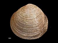
Images: Semele vestalis (Reeve, 1853)
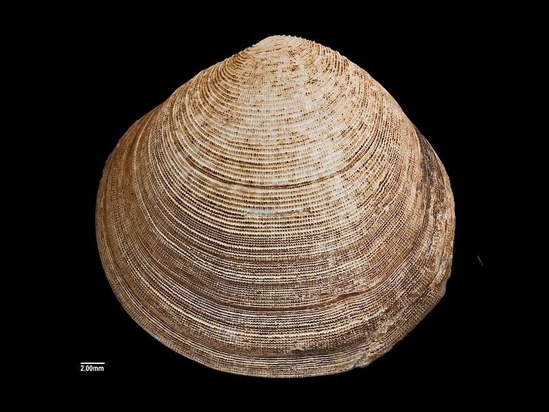
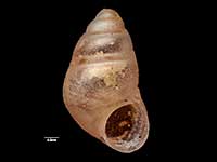
Holotype of Semele brambleyae Powell, 1967, collected Orua Bay, Manukau Harbour, Auckland, NZ (MA71299). 32mm. © Auckland Museum (CC-BY)
Taxonomy
Family: SEMELIDAE Full Classification: Genus Synonyms: =Amphidesma Lamarck, 1818 =Semele (Amphidesma) Lamarck, 1818 accepted, alternate representation =Semele (Elegantula) de de Gregorio, 1885 accepted, alternate representation =Semele (Semele) Schumacher, 1817 accepted, alternate representation Synonymised Names: =Amphidesma vestalis Reeve, 1853 |
Details: Semele vestalis (Reeve, 1853)
Size/Grows to:
Width 32mm, Height 31mm
Distribution:
North Island
Geographical Range:
A
Notes:
Species Links
Distribution Map
References and Publications
- Powell, A.W.B. 1979 New Zealand Mollusca: Marine, Land and Freshwater Shells, Collins, Auckland (p.419)
- Powell, A.W.B. 1967 New Zealand Molluscan Systematics with Descriptions of New Species: Part 6, Records of the Auckland Institute and Museum, 6(3) (p.196)
Key to Geographical Ranges

The symbols K.A.C.F.M.An. are used to indicate the geographical range of the species.
They have been adopted to give an approximation of the range of each species within New Zealand.
K=
Kermadec Islands
A=
Aupourian - Kaipara Harbour, north around North Cape, encompassing the Three Kings Islands and south to East Cape
C=
Cookian - Lower North Island and the northern part of the South Island
F=
Forsterian - Otago, Fiordland and Stewart Island
M=
Moriorian - Chatham Islands, Pitt Island
An=
Antipodean - Subantarctic Islands of New Zealand
Fw =
Freshwater
L =
Land
N =
North Island
S =
South Island
R =
Recent
Sf =
Subfossil
Fo =
Fossil
Compare Species (
/6)