Compare Gaimardia forsteriana
| toggle to add to compare list |
Taxonomy
Family: GAIMARDIIDAE Full Classification: Mollusca (Phylum) > Bivalvia (Class) > Autobranchia (Subclass) > Heteroconchia (Infraclass) > Euhetrodonta (Subterclass) > Imparidentia (Superorder) > Gaimardioidea (Superfamily) > Gaimardiidae (Family) > Gaimardia (Genus) > forsteriana (Species) Genus Synonyms: =Gaimardia (Gaimardia) Gould, 1852 accepted, alternate representation =Gaimardia (Neogaimardia) Odhner, 1924 accepted, alternate representation =Gaimardia (Progaimardia) Ponder, 1971 accepted, alternate representation =Neogaimardia Odhner, 1924 =Phaseolicama Rousseau in Hombron & Jacquinot, 1854 |
Images: Gaimardia forsteriana Finlay, 1927
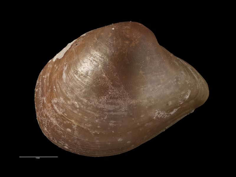
Holotype, collected Taieri Beach, Otago, NZ (MA70336). 4mm. © Auckland Museum (CC-BY)
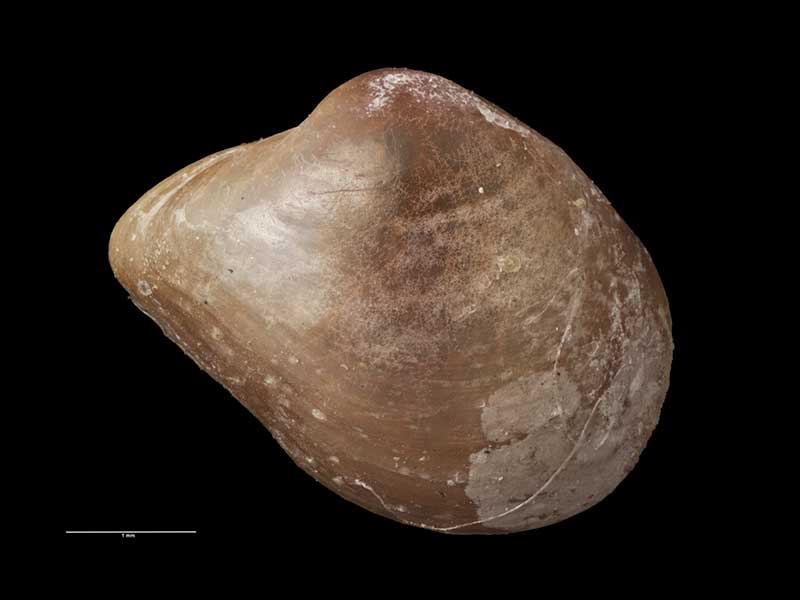
Holotype, collected Taieri Beach, Otago, NZ (MA70336). 4mm. © Auckland Museum (CC-BY)
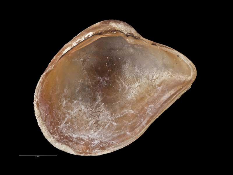
Holotype, collected Taieri Beach, Otago, NZ (MA70336). 4mm. © Auckland Museum (CC-BY)
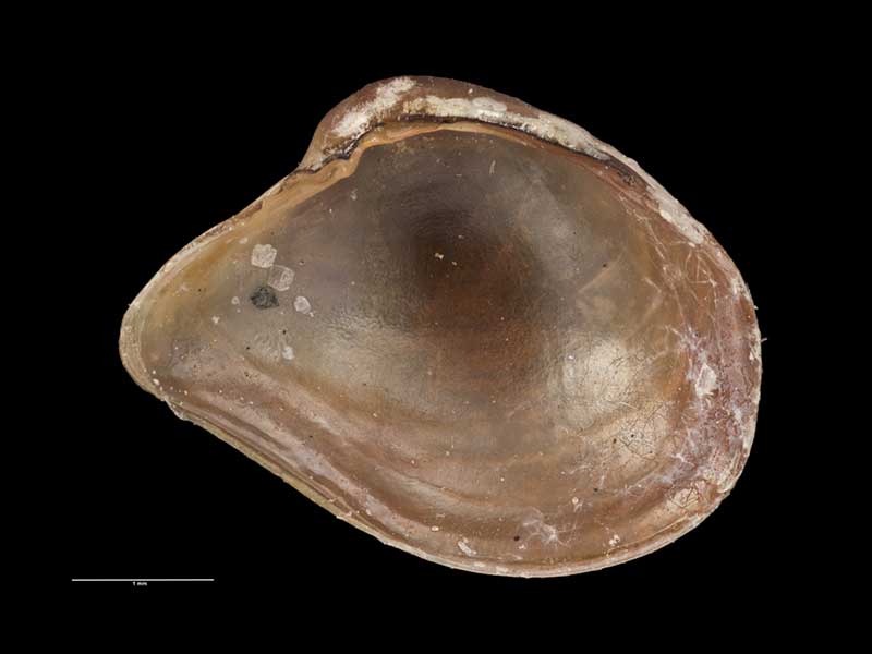
Holotype, collected Taieri Beach, Otago, NZ (MA70336). 4mm. © Auckland Museum (CC-BY)
Taxonomy
Family: GAIMARDIIDAE Full Classification: Mollusca (Phylum) > Bivalvia (Class) > Autobranchia (Subclass) > Heteroconchia (Infraclass) > Euhetrodonta (Subterclass) > Imparidentia (Superorder) > Gaimardioidea (Superfamily) > Gaimardiidae (Family) > Gaimardia (Genus) > forsteriana (Species) Genus Synonyms: =Gaimardia (Gaimardia) Gould, 1852 accepted, alternate representation =Gaimardia (Neogaimardia) Odhner, 1924 accepted, alternate representation =Gaimardia (Progaimardia) Ponder, 1971 accepted, alternate representation =Neogaimardia Odhner, 1924 =Phaseolicama Rousseau in Hombron & Jacquinot, 1854 |
Details: Gaimardia forsteriana Finlay, 1927
Size/Grows to:
Width 4mm, Height 3mm
Distribution:
South-eastern South Island, and Stewart, Campbell and Chatham Islands. Low tide & shallow sublittoral
Geographical Range:
FMAn
Notes:
Species Links
Distribution Map
References and Publications
- Powell, A.W.B. 1979 New Zealand Mollusca: Marine, Land and Freshwater Shells, Collins, Auckland (p.420)
- Finlay, H. 1926 A Further Commentary on New Zealand Molluscan Systematics, Transactions and Proceedings of the Royal Society of New Zealand, 57 (p.456) Original Description
*98 © Museum of New Zealand Te Papa Tongarewa (CC-BY-NC-ND)
Key to Geographical Ranges

The symbols K.A.C.F.M.An. are used to indicate the geographical range of the species.
They have been adopted to give an approximation of the range of each species within New Zealand.
K=
Kermadec Islands
A=
Aupourian - Kaipara Harbour, north around North Cape, encompassing the Three Kings Islands and south to East Cape
C=
Cookian - Lower North Island and the northern part of the South Island
F=
Forsterian - Otago, Fiordland and Stewart Island
M=
Moriorian - Chatham Islands, Pitt Island
An=
Antipodean - Subantarctic Islands of New Zealand
Fw =
Freshwater
L =
Land
N =
North Island
S =
South Island
R =
Recent
Sf =
Subfossil
Fo =
Fossil
Recently Viewed

Compare Species (
/6)