Compare Tawera spissa
| toggle to add to compare list |
Taxonomy
Family: VENERIDAE Full Classification: Genus Synonyms: =Plurigens Finlay, 1930 Synonymised Names: =Chamelea spissa (Deshayes, 1835) =Chione gibbosa Hutton, 1873 =Venus (Murcia) scansilis Römer, 1860 =Venus crassa Quoy & Gaimard, 1835 =Venus denticulata Quoy & Gaimard, 1835 =Venus mesodesma Quoy & Gaimard, 1835 =Venus spissa Deshayes, 1835 =Venus violacea Quoy & Gaimard, 1835 |
Images: Tawera spissa (Deshayes, 1835)
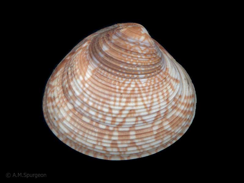
In beach drift, Whangaroa, Northland, NZ. 24mm
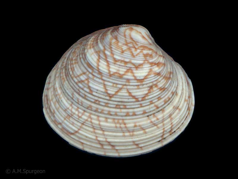
In beach drift, Whangaroa, Northland, NZ. 24mm
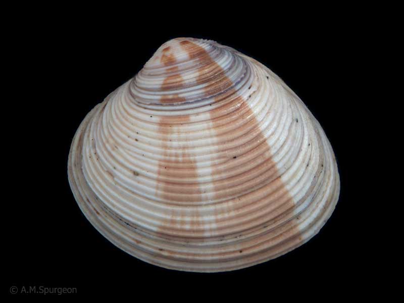
In beach drift, Whangaroa, Northland, NZ. 25mm
Taxonomy
Family: VENERIDAE Full Classification: Genus Synonyms: =Plurigens Finlay, 1930 Synonymised Names: =Chamelea spissa (Deshayes, 1835) =Chione gibbosa Hutton, 1873 =Venus (Murcia) scansilis Römer, 1860 =Venus crassa Quoy & Gaimard, 1835 =Venus denticulata Quoy & Gaimard, 1835 =Venus mesodesma Quoy & Gaimard, 1835 =Venus spissa Deshayes, 1835 =Venus violacea Quoy & Gaimard, 1835 |
Details: Tawera spissa (Deshayes, 1835)
Size/Grows to:
Width 34mm, Height 27mm
Distribution:
North, South, Stewart and Chatham Islands
Geographical Range:
ACFM
Notes:
Species Links
Distribution Map
References and Publications
- Eagle, M.K. Dec/2014 Tawera spissa (Bivalvia) Predation by Astropecten polyacanthus (Asteroidea) in Northland, New Zealand, Poirieria, 38 (p.28)
- Marshall, B.A., Spencer, H.G. 2013 Comments on some taxonomic changes affecting marine Bivalvia of the New Zealand region recently introduced in Huber's Compendium of bivalves, with some additional taxonomic changes, Molluscan Research, 33(1) (p.45)
- Beu, A.G. 2004 Marine Mollusca of oxygen isotope stages of the last 2 million years in New Zealand. Part 1: Revised generic positions and recognition of warm-water and cool-water migrants, Journal of the Royal Society of New Zealand, 34 (p.181)
- Cumber, R.A. Nov/1983 Colour patterns of Tawera spissa (Deshayes, 1835) (Veneridae) in the Far North, Poirieria, 13(2)
- Powell, A.W.B. 1979 New Zealand Mollusca: Marine, Land and Freshwater Shells, Collins, Auckland (p.424)
Key to Geographical Ranges

The symbols K.A.C.F.M.An. are used to indicate the geographical range of the species.
They have been adopted to give an approximation of the range of each species within New Zealand.
K=
Kermadec Islands
A=
Aupourian - Kaipara Harbour, north around North Cape, encompassing the Three Kings Islands and south to East Cape
C=
Cookian - Lower North Island and the northern part of the South Island
F=
Forsterian - Otago, Fiordland and Stewart Island
M=
Moriorian - Chatham Islands, Pitt Island
An=
Antipodean - Subantarctic Islands of New Zealand
Fw =
Freshwater
L =
Land
N =
North Island
S =
South Island
R =
Recent
Sf =
Subfossil
Fo =
Fossil
Recently Viewed

Compare Species (
/6)