Compare Dosinia lambata
| toggle to add to compare list |
Taxonomy
Family: VENERIDAE Full Classification: Genus Synonyms: =Dosinia (Asa) Basterot, 1825 =Dosinia (Austrodosinia) Dall, 1902 =Dosinia (Fallartemis) Iredale, 1930 =Dosinia (Kereia) Marwick, 1927 =osinia (Pectunculus) da Costa, 1778 =Dosinia (Phacosoma) Jukes-Browne, 1912 Synonymised Names: =Arthemis lambata Gould, 1850 =Dosinia (Fallartemis) lambata (Gould, 1850) |
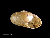
Images: Dosinia lambata (Gould, 1850)
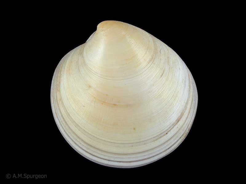
Wattle Bay, Manukau Harbour, Auckland, NZ. 28mm
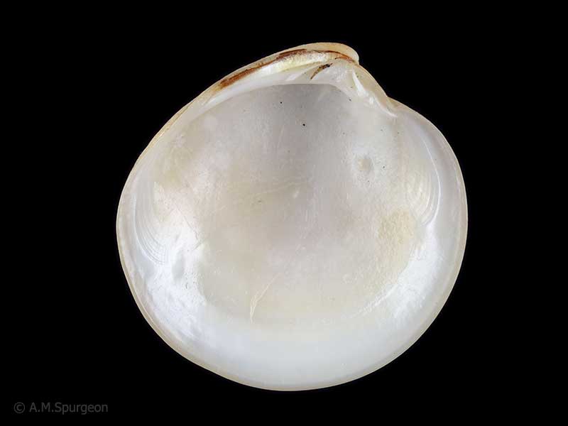
Wattle Bay, Manukau Harbour, Auckland, NZ. 28mm
Taxonomy
Family: VENERIDAE Full Classification: Genus Synonyms: =Dosinia (Asa) Basterot, 1825 =Dosinia (Austrodosinia) Dall, 1902 =Dosinia (Fallartemis) Iredale, 1930 =Dosinia (Kereia) Marwick, 1927 =osinia (Pectunculus) da Costa, 1778 =Dosinia (Phacosoma) Jukes-Browne, 1912 Synonymised Names: =Arthemis lambata Gould, 1850 =Dosinia (Fallartemis) lambata (Gould, 1850) |
Details: Dosinia lambata (Gould, 1850)
Size/Grows to:
Width 40mm, Height 35mm
Distribution:
North Island, and South Island as far south as Dunedin
Geographical Range:
ACF
Notes:
Species Links
Distribution Map
References and Publications
- Huber, M. 2010 Compendium of Bivalves 1, ConchBooks: Hackenheim, Germany (p.736)
- Powell, A.W.B. 1979 New Zealand Mollusca: Marine, Land and Freshwater Shells, Collins, Auckland (p.423)
- Gould, A. 1850 Descriptions of new species of shells from the United States Exploring Expedition, Proceedings of the Boston Society of Natural History, 3 (p.277) Original Description
*98 © Museum of New Zealand Te Papa Tongarewa (CC-BY-NC-ND)
Key to Geographical Ranges

The symbols K.A.C.F.M.An. are used to indicate the geographical range of the species.
They have been adopted to give an approximation of the range of each species within New Zealand.
K=
Kermadec Islands
A=
Aupourian - Kaipara Harbour, north around North Cape, encompassing the Three Kings Islands and south to East Cape
C=
Cookian - Lower North Island and the northern part of the South Island
F=
Forsterian - Otago, Fiordland and Stewart Island
M=
Moriorian - Chatham Islands, Pitt Island
An=
Antipodean - Subantarctic Islands of New Zealand
Fw =
Freshwater
L =
Land
N =
North Island
S =
South Island
R =
Recent
Sf =
Subfossil
Fo =
Fossil

Compare Species (
/6)