Compare Leptopyrgus manneringi
| toggle to add to compare list |
Taxonomy
Family: TATEIDAE Full Classification: Mollusca (Phylum) > Gastropoda (Class) > Caenogastropoda (Subclass) > Littorinimorpha (Order) > Truncatelloidea (Superfamily) > Tateidae (Family) > Leptopyrgus (Genus) > manneringi (Species) Synonymised Names: =Potamopyrgus manneringi Climo, 1974 |
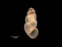
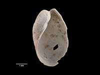
Images: Leptopyrgus manneringi (Climo, 1974)
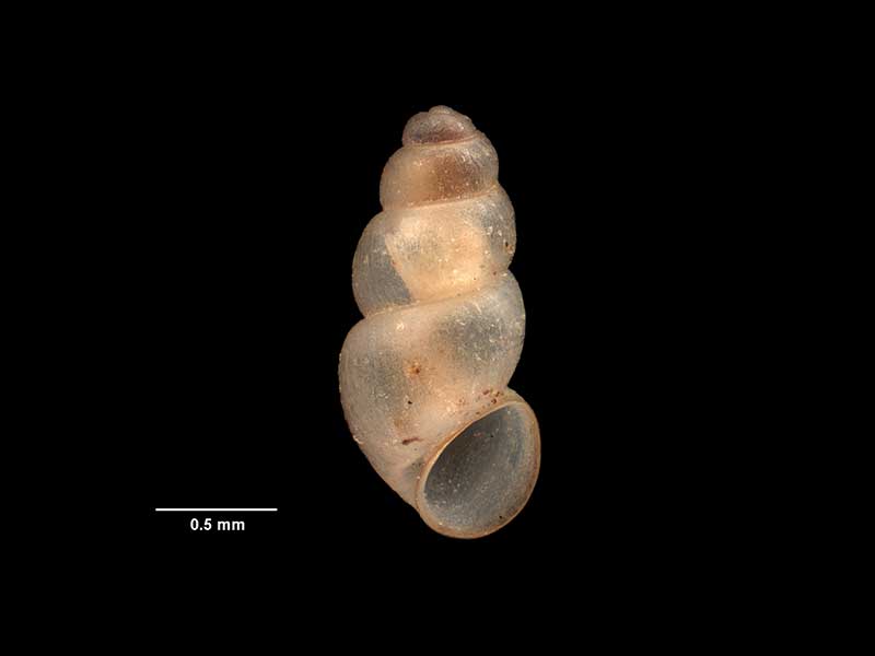
Holotype of Potamopyrgus manneringi Climo, 1974, collected Sep 1971, N of Raglan, W of Waikaretu, limestone cliff N bank of Waikaretu Stream, between major bend & junction with N-flowing stream., NZ (M.032438). 1.8mm. © Museum of New Zealand Te Papa Tongarewa (CC-BY-NC-ND)
Taxonomy
Family: TATEIDAE Full Classification: Mollusca (Phylum) > Gastropoda (Class) > Caenogastropoda (Subclass) > Littorinimorpha (Order) > Truncatelloidea (Superfamily) > Tateidae (Family) > Leptopyrgus (Genus) > manneringi (Species) Synonymised Names: =Potamopyrgus manneringi Climo, 1974 |
Details: Leptopyrgus manneringi (Climo, 1974)
Size/Grows to:
Height 2.5mm
Distribution:
North Island. North of Raglan
Geographical Range:
Fw.N.
Notes:
Species Links
Distribution Map
References and Publications
- Haase, M. 2008 The radiation of hydrobiid gastropods in New Zealand: a revision including the description of new species based on morphology and mtDNA sequence information, Systematics and Biodiversity, 6(1) (p.116)
- Powell, A.W.B. 1979 New Zealand Mollusca: Marine, Land and Freshwater Shells, Collins, Auckland (p.122)
- Climo, F.M. 1974 Description and affinities of the subterranean molluscan fauna of New Zealand, New Zealand Journal of Zoology, 1(3) (p.261) Original Description
Key to Geographical Ranges

The symbols K.A.C.F.M.An. are used to indicate the geographical range of the species.
They have been adopted to give an approximation of the range of each species within New Zealand.
K=
Kermadec Islands
A=
Aupourian - Kaipara Harbour, north around North Cape, encompassing the Three Kings Islands and south to East Cape
C=
Cookian - Lower North Island and the northern part of the South Island
F=
Forsterian - Otago, Fiordland and Stewart Island
M=
Moriorian - Chatham Islands, Pitt Island
An=
Antipodean - Subantarctic Islands of New Zealand
Fw =
Freshwater
L =
Land
N =
North Island
S =
South Island
R =
Recent
Sf =
Subfossil
Fo =
Fossil
Compare Species (
/6)