Compare Fulgurofusus maxwelli
| toggle to add to compare list |
Taxonomy
Family: COLUMBARIIDAE Full Classification: Mollusca (Phylum) > Gastropoda (Class) > Caenogastropoda (Subclass) > Neogastropoda (Order) > Turbinelloidea (Superfamily) > Columbariidae (Family) > Fulgurofusus (Genus) > maxwelli (Species) Genus Synonyms: =Fulgurofusus (Fulgurofusus) Grabau, 1904 =Fulgurofusus (Histricosceptrum) Darragh, 1969 =Histricosceptrum Darragh, 1969 |
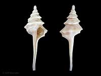
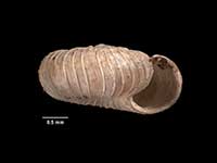
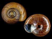
Images: Fulgurofusus maxwelli Harasewych, 2011

Trawled at 760 metres, Bounty Plateau. 30mm
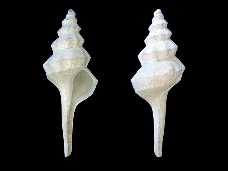
Trawled at 720 metres, Bounty Plateau. ~40mm
Taxonomy
Family: COLUMBARIIDAE Full Classification: Mollusca (Phylum) > Gastropoda (Class) > Caenogastropoda (Subclass) > Neogastropoda (Order) > Turbinelloidea (Superfamily) > Columbariidae (Family) > Fulgurofusus (Genus) > maxwelli (Species) Genus Synonyms: =Fulgurofusus (Fulgurofusus) Grabau, 1904 =Fulgurofusus (Histricosceptrum) Darragh, 1969 =Histricosceptrum Darragh, 1969 |
Details: Fulgurofusus maxwelli Harasewych, 2011
Size/Grows to:
Height 86mm
Distribution:
Northern Bounty Trough, the Bounty Plateau, and the eastern margins of the Campbell Plateau, 476-1386 metres
Geographical Range:
CFMAn
Notes:
Species Links
Distribution Map
References and Publications
- Harasewych, M.G. 2011 The Living Columbariinae (Gastropoda: Neogastropoda: Turbinellidae) of New Zealand, Zootaxa, 2744 (p.24) Original Description
*98 © Museum of New Zealand Te Papa Tongarewa (CC-BY-NC-ND)
Key to Geographical Ranges

The symbols K.A.C.F.M.An. are used to indicate the geographical range of the species.
They have been adopted to give an approximation of the range of each species within New Zealand.
K=
Kermadec Islands
A=
Aupourian - Kaipara Harbour, north around North Cape, encompassing the Three Kings Islands and south to East Cape
C=
Cookian - Lower North Island and the northern part of the South Island
F=
Forsterian - Otago, Fiordland and Stewart Island
M=
Moriorian - Chatham Islands, Pitt Island
An=
Antipodean - Subantarctic Islands of New Zealand
Fw =
Freshwater
L =
Land
N =
North Island
S =
South Island
R =
Recent
Sf =
Subfossil
Fo =
Fossil
Compare Species (
/6)