Compare Bathymodiolus manusensis
| toggle to add to compare list |
Taxonomy
Family: Subfamily: MYTILIDAE: BATHYMODIOLINAE Full Classification: Mollusca (Phylum) > Bivalvia (Class) > Pteriomorphia (Subclass) > Mytilida (Order) > Mytiloidea (Superfamily) > Mytilidae (Family) > Bathymodiolinae (Subfamily) > Bathymodiolus (Genus) > manusensis (Species) |
Images: Bathymodiolus manusensis Hashimoto & Furuta, 2007
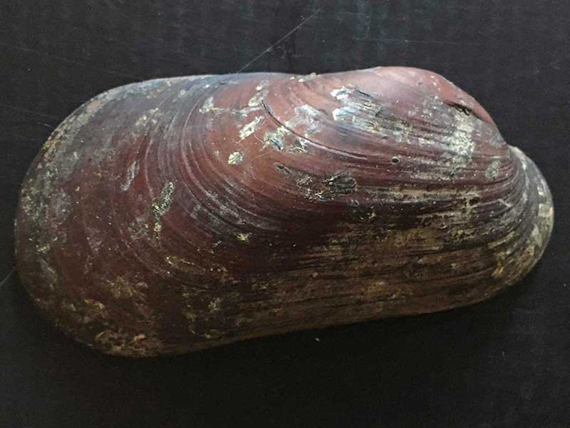
Monowai Seamount, Kermadec Ridge, 1000 metres. ~90mm. rights reserved
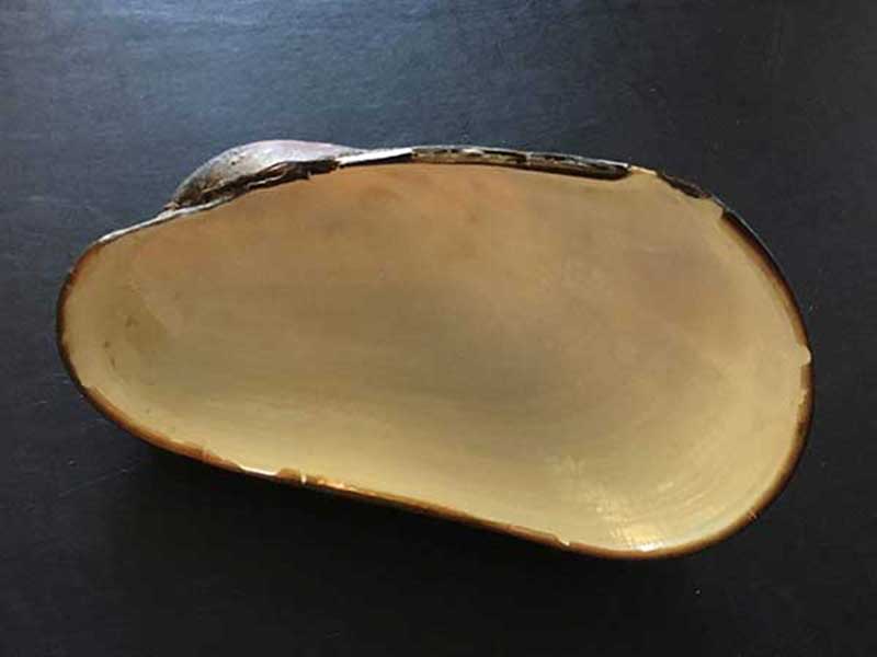
Monowai Seamount, Kermadec Ridge, 1000 metres. ~90mm. rights reserved
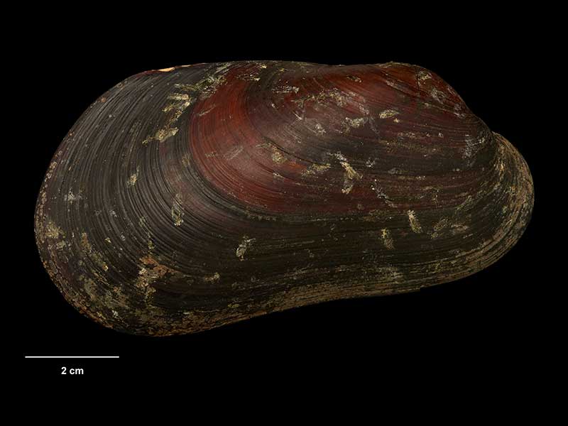
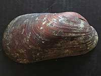
Collected 3 May 2007, 1000 metres, Monowai Seamount, Kermadec Ridge (M.274919). ~90mm. © Museum of New Zealand Te Papa Tongarewa (CC-BY-NC-ND)
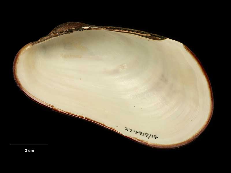
Collected 3 May 2007, 1000 metres, Monowai Seamount, Kermadec Ridge (M.274919). ~90mm. © Museum of New Zealand Te Papa Tongarewa (CC-BY-NC-ND)
Taxonomy
Family: Subfamily: MYTILIDAE: BATHYMODIOLINAE Full Classification: Mollusca (Phylum) > Bivalvia (Class) > Pteriomorphia (Subclass) > Mytilida (Order) > Mytiloidea (Superfamily) > Mytilidae (Family) > Bathymodiolinae (Subfamily) > Bathymodiolus (Genus) > manusensis (Species) |
Details: Bathymodiolus manusensis Hashimoto & Furuta, 2007
Distribution:
Kermadec Ridge, SSW of Tonga, Monowai Caldera, 1143 metres
Geographical Range:
K
Notes:
Species Links
Distribution Map
References and Publications
- Hashimoto, J., Furuta, M. 2007 A new species of Bathymodiolus (Bivalvia: Mytilidae) from hydrothermal vent communities in the Manus Basin, Papua New Guinea, Venus, 66(1) (p.57) Original Description
Key to Geographical Ranges

The symbols K.A.C.F.M.An. are used to indicate the geographical range of the species.
They have been adopted to give an approximation of the range of each species within New Zealand.
K=
Kermadec Islands
A=
Aupourian - Kaipara Harbour, north around North Cape, encompassing the Three Kings Islands and south to East Cape
C=
Cookian - Lower North Island and the northern part of the South Island
F=
Forsterian - Otago, Fiordland and Stewart Island
M=
Moriorian - Chatham Islands, Pitt Island
An=
Antipodean - Subantarctic Islands of New Zealand
Fw =
Freshwater
L =
Land
N =
North Island
S =
South Island
R =
Recent
Sf =
Subfossil
Fo =
Fossil
Recently Viewed
Compare Species (
/6)