Compare Falsilunatia powelli
| toggle to add to compare list |
Taxonomy
Family: Subfamily: NATICIDAE: GLOBISININAE Full Classification: Mollusca (Phylum) > Gastropoda (Class) > Caenogastropoda (Subclass) > Littorinimorpha (Order) > Naticoidea (Superfamily) > Naticidae (Family) > Globisininae (Subfamily) > Falsilunatia (Genus) > powelli (Species) |
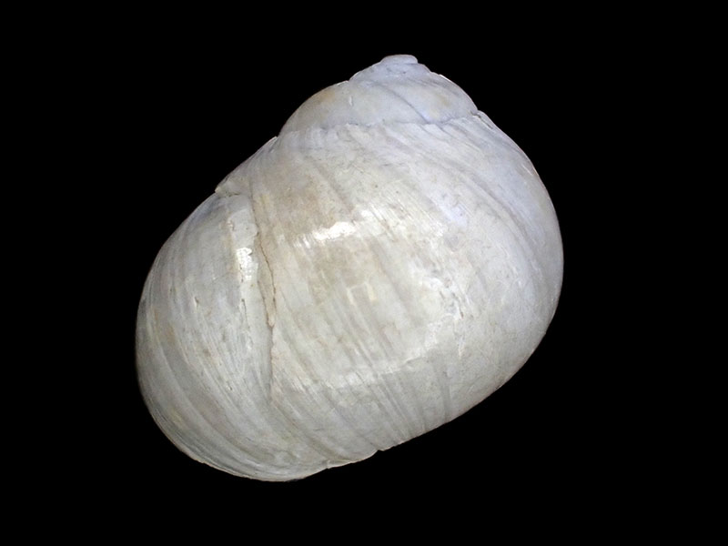
Images: Falsilunatia powelli Dell, 1956
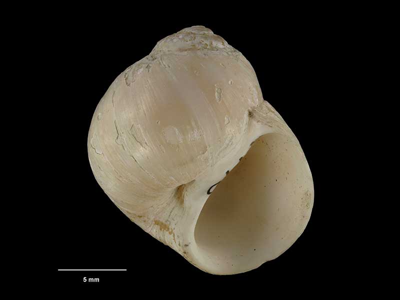
Holotype of Falsilunatia powelli Dell, 1956, collected 24 Jan 1954, Chatham Rise, NZ (M.009770). 18mm. © Museum of New Zealand Te Papa Tongarewa (CC-BY-NC-ND)

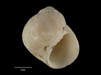
500-600 metres, center of Papanui Canyon, off Otago Peninsula, NZ
500-600 metres, center of Papanui Canyon, off Otago Peninsula, NZ
Taxonomy
Family: Subfamily: NATICIDAE: GLOBISININAE Full Classification: Mollusca (Phylum) > Gastropoda (Class) > Caenogastropoda (Subclass) > Littorinimorpha (Order) > Naticoidea (Superfamily) > Naticidae (Family) > Globisininae (Subfamily) > Falsilunatia (Genus) > powelli (Species) |
Details: Falsilunatia powelli Dell, 1956
Size/Grows to:
Height 18mm
Distribution:
Challenger Plateau, South Island, Campbell Plateau, Antipodes and Bounty Islands, and Chatham Rise
Geographical Range:
CFMAn
Notes:
Species Links
Distribution Map
References and Publications
- Powell, A.W.B. 1979 New Zealand Mollusca: Marine, Land and Freshwater Shells, Collins, Auckland (p.157)
- Dell, R.K. 1956 The archibenthal Mollusca of New Zealand, Dominion Museum Bulletin, 18 (p.74) Original Description
Key to Geographical Ranges

The symbols K.A.C.F.M.An. are used to indicate the geographical range of the species.
They have been adopted to give an approximation of the range of each species within New Zealand.
K=
Kermadec Islands
A=
Aupourian - Kaipara Harbour, north around North Cape, encompassing the Three Kings Islands and south to East Cape
C=
Cookian - Lower North Island and the northern part of the South Island
F=
Forsterian - Otago, Fiordland and Stewart Island
M=
Moriorian - Chatham Islands, Pitt Island
An=
Antipodean - Subantarctic Islands of New Zealand
Fw =
Freshwater
L =
Land
N =
North Island
S =
South Island
R =
Recent
Sf =
Subfossil
Fo =
Fossil
Recently Viewed
Compare Species (
/6)